Near Tiburon in Marin County, California — The American West (Pacific Coastal)
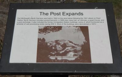
The Post Expands
Topics. This historical marker is listed in these topic lists: Military • War, World II. A significant historical year for this entry is 1942.
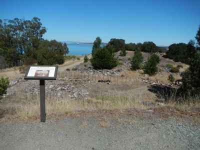
Location. 37° 52.072′ N, 122° 25.46′ W. Marker is near Tiburon, California, in Marin County. Marker is on Perimeter Road, on the right. Touch for map. Marker is in this post office area: Belvedere Tiburon CA 94920, United States of America. Touch for directions.
Other nearby markers. At least 8 other markers are within walking distance of this marker. Staff Housing (about 300 feet away, measured in a direct line); US Immigration Station (about 300 feet away); A Garden Setting (about 300 feet away); Mule Barn (about 300 feet away); Water Reservoir (about 500 feet away); Asian Men's Recreation Yard (about 700 feet away); Hospital (about 700 feet away); Separate Doors (approx. 0.2 miles away). Touch for a list and map of all markers in Tiburon.
More about this marker. Angel Island State Park is accessed by ferry from Tiburon or San Francisco. Perimeter Road is a 5 mile, mostly paved, walking/bicycle path that goes around Angel Island. This marker is located at Fort McDowell.
Credits. This page was last revised on June 16, 2016. It was originally submitted on October 14, 2013, by Barry Swackhamer of Brentwood, California. This page has been viewed 477 times since then and 10 times this year. Last updated on November 16, 2013, by Barry Swackhamer of Brentwood, California. Photos: 1, 2. submitted on October 14, 2013, by Barry Swackhamer of Brentwood, California. • Andrew Ruppenstein was the editor who published this page.

