Near Ramsey in Anoka County, Minnesota — The American Midwest (Upper Plains)
Ice Age Souvenir
— Great River Road Minnesota —
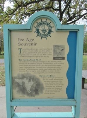
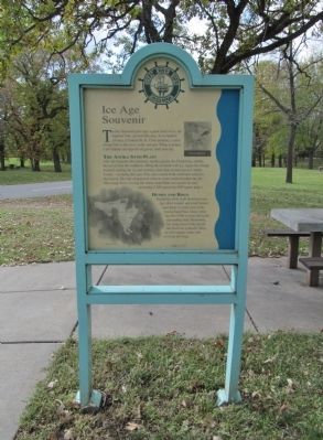
Twenty thousand years ago, a great sheet of ice, the Superior lobe, covered this area. At its farthest advance, it formed the St. Croix moraine, a series of high hills to the west, south, and east. When it melted, it left behind vast deposits of gravel, sand, and clay.
The Anoka Sand Plain
After the Superior lobe retreated, another glacier, the Grantsburg sublobe, moved in from the southwest, filling the lowlands with ice. Again the climate warmed, melting the ice and creating a lake that covered most of Anoka County – including this spot. Fine sand carried in the meltwater settled to the bottom. The lake disappeared when its water found an outlet into the Mississippi River, leaving the Anoka Sand Plain, an expanse of sand measuring 2,200 square km (850 square miles).
Dunes and Bogs
Beginning about eight thousand years ago, drier weather and wind formed sand dunes in some areas of the Anoka Sand Plain. Dunes often rise 9m (30 ft) or more above the surrounding land. Meanwhile, low-lying areas of the glacial lake basin are gradually filling up with organic matter and evolving into bogs.
reverse side
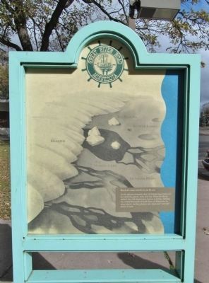
Kettle Lakes and Outwash Plains
As the glaciers retreated, they left behind huge blocks of ice buried by gravel, sand, and clay. When the blocks melted, they left depressions, known as kettles. Melting ice created thousands of kettle lakes in Minnesota. In many places, melting glaciers also deposited "outwash" plains of sand.
Erected 1995 by Minnesota Department of Natural Resource Great River Road marker program.
Topics and series. This historical marker is listed in this topic list: Natural Features. In addition, it is included in the Minnesota Great River Road series list.
Location. 45° 14.743′ N, 93° 30.281′ W. Marker is near Ramsey, Minnesota, in Anoka County. Marker is on U.S. 10, 0.8 miles east of Cleveland Street, on the right when traveling east. Marker is in the eastbound Dayton Port Rest Area / Itasca Wayside along the Mississippi River. Touch for map. Marker is at or near this postal address: 95511 US Highway 10, Anoka MN 55303, United States of America. Touch for directions.
Other nearby markers. At least 8 other markers are within 7 miles of this marker, measured as the crow flies. Itasca Village Townsite (within shouting distance of this marker); Grange Shrine (approx. 1.9 miles away); Geology of the Elk River Region (approx. 4.3 miles away); Aaron Greenwald (approx. 6.3 miles away); Windego Park Auditorium (approx. 6.4 miles away); Washburn Saw Mill (approx. 6.4 miles away); Rum River Dam (approx. 6.4 miles away); Perseverance Needed (approx. 6.4 miles away).
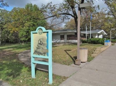
More about this marker. There are two maps on the northern side of the marker – Glacial Routes and the Anoka Sand Plain. On the southern side of the marker is an illustration of a melting glacier. Illustrations on both sides of the marker are by Bill Cannon.
Also see . . .
1. Glacial history of Minnesota. Wikipedia entry. (Submitted on November 18, 2013.)
2. Minnesota Department of Transportation. Historic Roadside Development Structures Inventory. (Submitted on November 18, 2013.)
Credits. This page was last revised on October 13, 2020. It was originally submitted on November 18, 2013, by Keith L of Wisconsin Rapids, Wisconsin. This page has been viewed 934 times since then and 29 times this year. Photos: 1, 2, 3, 4. submitted on November 18, 2013, by Keith L of Wisconsin Rapids, Wisconsin.


