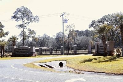
Near Starke in Clay County, Florida — The American South (South Atlantic)
Camp Blanding
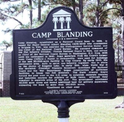
Camp Blanding, established as a National Guard base in 1939, is named for Major General Albert Blanding (1876-1970) who commanded a brigade in WWI, was awarded the Distinguished Service Medal, and was Chief of the National Guard Bureau. He assumed command of the 31st Infantry Division, Florida National Guard in 1924, and served as chief of the National Guard Bureau in Washington, D.C. from 1936 until his retirement in 1940. Some materials from the Guard's former base, Camp Clifford J. Foster in Jacksonville, were used for buildings at the new 30,000-acre facility in Clay County. By early 1940, the cantonment area, built to serve one infantry regiment, was in place on the shores of Kingsley Lake. In early 1941, when World War II was declared, President Franklin Roosevelt mobilized the National Guard and the War Department began construction of sufficient facilities to house two full divisions. The State Armory Board turned the post over to the U.S. Army to establish separate training and induction centers for soldiers of both races, although they remained in separate areas of the post. The government purchased 40,000 more acres and leased additional land for military maneuvers, expanding the base to more than 150,000 acres.
Reverse:
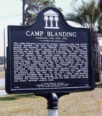
The Camp Blanding construction project employed more than 22,000 civilian workers, who built more than 10,000 buildings to accommodate two divisions, about 60,000 trainees. By 1941, Camp Blanding was the fourth largest city in Florida. In addition to housing and mess halls, maintenance buildings, PXs, field artillery and rifle ranges, the camp had a 2,800-bed hospital, enlisted men's and officer's clubs, bowling alleys, four theaters, and five chapels. The first unit trained here was the 31st Division ("Dixie Division"), National Guard units from four southern states. The 43rd Division, composed of men from New England, arrived in February 1941. During World War II, approximately one million men received basic training here, the largest of Florida's 142 military installations built in the 1940s. A prisoner of war compound, established for about 1,200 captured German soldiers and sailors, was maintained until the prisoners were repatriated to Germany after the war. At the war's end in 1945, many temporary buildings were sold as surplus. In 1955, Camp Blanding Military Reservation was returned to the State Armory Board for training the National Guard in Florida and other states and active and armed services reserve units.
Erected 2008 by The Florida National Guard and The Florida Department of State. (Marker Number F-655.)
Topics. This historical marker is listed in this topic list: Military. A significant historical month for this entry is February 1941.
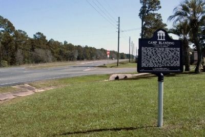
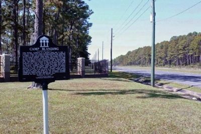
Location. 29° 58.891′ N, 81° 59.066′ W. Marker is near Starke, Florida, in Clay County. Marker is on State Road 16 near Tallahassee Street, on the right when traveling east. Located near the Main Gate entrance. In Clay County, while the postal address of Starke is in Bradford County. Touch for map. Marker is at or near this postal address: 5629 State Road 16 West, Starke FL 32091, United States of America. Touch for directions.
Other nearby markers. At least 8 other markers are within walking distance of this marker. The Military Order of the World Wars (within shouting distance of this marker); First Infantry Division (within shouting distance of this marker); 29th Infantry Division (within shouting distance of this marker); D Day (within shouting distance of this marker); Gun, 75 MM, M1897A2 (within shouting distance of this marker); 30th Infantry Division (about 300 feet away, measured in a direct line); 31st Infantry Division (about 300 feet away); Identification Plaque for Borne (about 300 feet away). Touch for a list and map of all markers in Starke.
Credits. This page was last revised on July 31, 2017. It was originally submitted on November 20, 2013, by Mike Stroud of Bluffton, South Carolina. This page has been viewed 864 times since then and 23 times this year. Photos: 1, 2, 3, 4, 5. submitted on November 21, 2013, by Mike Stroud of Bluffton, South Carolina.
