Near Shingletown in Shasta County, California — The American West (Pacific Coastal)
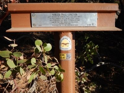
Nobles Trail – Junction
Guidebook Available
Trails West Inc., P.O. Box 12045, Reno, NV 89510
Erected 2007 by Trails West Inc. (Marker Number N - 53.)
Topics and series. This historical marker is listed in this topic list: Roads & Vehicles. In addition, it is included in the California Trail, the Nobles Trail, and the Trails West Inc. series lists.
Location. 40° 31.008′ N, 121° 48.227′ W. Marker is near Shingletown, California, in Shasta County. Marker is on Ritts Mill Road north of California Highway 44, on the right when traveling north. Touch for map. Marker is in this post office area: Shingletown CA 96088, United States of America. Touch for directions.
Other nearby markers. At least 8 other markers are within 7 miles of this marker, measured as the crow flies. Nobles Trail - Battle Creek Ford (approx. 4 miles away); Noble’s Bungalow (approx. 4.2 miles away); Nobles Emigrant Trail (approx. 4.7 miles away); Shingletown Store (approx. 4.7 miles away); Nobles Trail - Shingletown (approx. 4.8 miles away); Nobles Trail - Deer Flat (approx. 6.2 miles away); Manton Store (approx. 6.7 miles away); Forward Brothers Sawmill (approx. 6.7 miles away). Touch for a list and map of all markers in Shingletown.
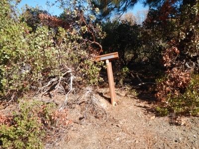
More about this marker. This marker is on Ritts Mill Road where the road makes a right-hand turn and the city dump road continues straight ahead.
Credits. This page was last revised on June 16, 2016. It was originally submitted on November 22, 2013, by Barry Swackhamer of Brentwood, California. This page has been viewed 425 times since then and 11 times this year. Photos: 1, 2. submitted on November 22, 2013, by Barry Swackhamer of Brentwood, California. • Syd Whittle was the editor who published this page.

