Near Brevard in Transylvania County, North Carolina — The American South (South Atlantic)
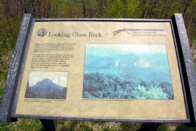
Looking Glass Rock
Photographed by Duane Hall, April 30, 2010
1. Looking Glass Rock Marker
Looking Glass Rock is a pluton formed by underground volcanic activity. Plutons are great masses of molten rock that have hardened under the earth's surface. Centuries of erosion finally exposed the rock and shaped it into the familiar dome we see today.
(Left Photo Caption)
Looking Glass Rock has been a landmark in the southern Appalachian Mountains for generations.
(Right Photo Caption)
Looking Glass Rock's massive size can be easily appreciated close-up.
Erected by National Park Service.
Topics and series. This historical marker is listed in this topic list: Notable Places. In addition, it is included in the Blue Ridge Parkway series list.
Location. 35° 19.304′ N, 82° 49.678′ W. Marker is near Brevard, North Carolina, in Transylvania County. It can be reached from Blue Ridge Parkway (at milepost 417), on the right when traveling north. Touch for map. Marker is
this page online

Regionally, this marker is in the Mountains. It is also in the American South, specifically in the Upper South, in Appalachia, and specifically in Southern Appalachia. Globally, it is in North America, the Western Hemisphere, the Western World, and the Anglosphere. Historically, it finds itself in what was once the original Cherokee Nation, the territory of the Mississippian Culture, one of the original Thirteen Colonies, one of the Confederate States of America, and the Antebellum South.
Other nearby markers. At least 8 other markers are within 4 miles of this marker, measured as the crow flies: A different marker also named Looking Glass Rock (approx. 3.1 miles away); Forestry School (approx. 3.3 miles away); Draw Road (approx. 3.4 miles away); Wash Place (approx. 3.4 miles away); Hell Hole (approx. 3.4 miles away); Rock House Creek Lodge (approx. 3.4 miles away); Schenck's Office (approx. 3.4 miles away); Commissary (approx. 3.4 miles away). Touch for a list and map of all markers in Brevard.
Photographed by Duane Hall, April 30, 2010
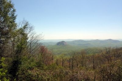
2. Looking Glass Rock as viewed from Marker
Photographed by Duane Hall, April 30, 2010
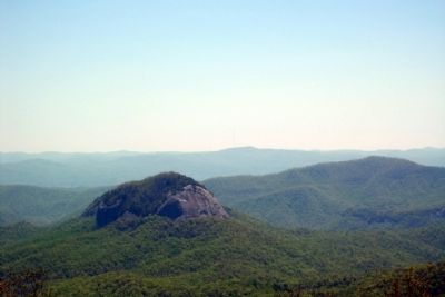
3. Looking Glass Rock
Credits. This page was last revised on June 16, 2016. It was originally submitted on November 25, 2013, by Duane Hall of Abilene, Texas. This page has been viewed 669 times since then and 34 times this year. Photos: 1, 2, 3. submitted on November 25, 2013, by Duane Hall of Abilene, Texas.
Editor’s want-list for this marker. Wide-view photo of marker. • Can you help?
