Mexico in Audrain County, Missouri — The American Midwest (Upper Plains)
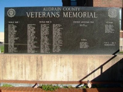
Audrain County Veterans Memorial
Photographed by William Fischer, Jr., October 12, 2013
1. Audrain County Veterans Memorial
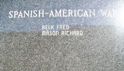
Spanish-American War
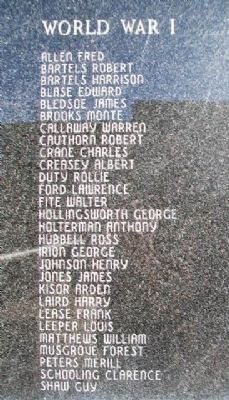
World War I
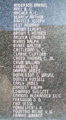
World War II
Korea
Vietnam
POW's - MIA's Remembered
Erected by Audrain County American Legion and Veterans of Foreign Wars.
Topics. This memorial is listed in this topic list: Military.
Location. 39° 10.365′ N, 91° 53.003′ W. Memorial is in Mexico, Missouri, in Audrain County. It is at the intersection of Washington Avenue and Monroe Street, on the left when traveling south on Washington Avenue. Memorial is on the west grounds of the county courthouse. Touch for map. Memorial is at or near this postal address: 101 North Jefferson Street, Mexico MO 65265, United States of America. Touch for directions.

Regionally, this memorial is in Little Dixie and in Mark Twain Country. It is also in the American Midwest, in the Lewis & Clark Corridor, and in the Corn Belt. Globally, it is in North America, the Western Hemisphere, the Western World, and the Anglosphere. Historically, it finds itself in what was once the territory of the Mississippian Culture, the Louisiana Purchase, and the Antebellum South.
this page online
Other nearby markers. At least 8 other markers are within walking distance of this marker: The Missouri Exercise Tiger Army & Navy Anchor Memorial (a few steps from this marker); John Bingle Morris (a few steps from this marker); a different marker also named John Bingle Morris (a few steps from this marker); Little Sisters of Liberty / Replica of the Statue of Liberty (within shouting distance of this marker); Rex McDonald 833 (approx. 0.4 miles away); Graceland (approx. 0.4 miles away); Mexico in the Civil War (approx. 0.4 miles away); Old Stones (approx. 0.4 miles away). Touch for a list and map of all markers in Mexico.
Photographed by William Fischer, Jr., October 12, 2013
2. Audrain County Veterans Memorial
Photographed by William Fischer, Jr., October 12, 2013
3. Audrain County Veterans Memorial
Photographed by William Fischer, Jr., October 12, 2013
4. Audrain County Veterans Memorial - WWII
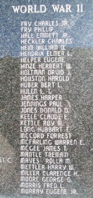
Photographed by William Fischer, Jr., October 12, 2013
5. Audrain County Veterans Memorial
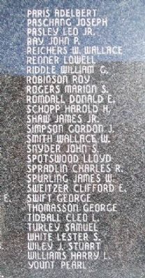
Photographed by William Fischer, Jr., October 12, 2013
6. Audrain County Veterans Memorial - WWII
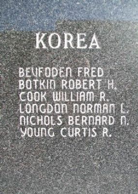
Photographed by William Fischer, Jr., October 12, 2013
7. Audrain County Veterans Memorial
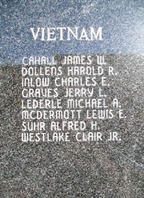
Photographed by William Fischer, Jr., October 12, 2013
8. Audrain County Veterans Memorial
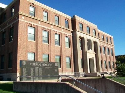
Photographed by William Fischer, Jr., October 12, 2013
9. Audrain County Veterans Memorial
Credits. This page was last revised on December 10, 2020. It was originally submitted on November 27, 2013, by William Fischer, Jr. of Reynoldsburg, Ohio. This page has been viewed 856 times since then and 31 times this year. Photos: 1, 2, 3, 4, 5, 6, 7, 8, 9. submitted on November 27, 2013, by William Fischer, Jr. of Reynoldsburg, Ohio.
