Mexico in Audrain County, Missouri — The American Midwest (Upper Plains)
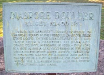
Diaspore Boulder
Weight 10,400 Lbs.
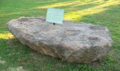
This is the largest "surface boulder" of Diaspore found in the Missouri Diaspore Fields lying south of the Missouri River. - It was taken from a diaspora pit near Aud, Osage County, Missouri, in 1926. - Diaspore is a high alumina clay occurring in this form with a fusion point above 3300°F. - chemically it consists mainly of alumina and water. Diaspore is a raw material or clay from which the A. P. Green high alumina super refractories are made.
Topics. This historical marker is listed in these topic lists: Environment • Industry & Commerce. A significant historical year for this entry is 1926.
Location. 39° 10.123′ N, 91° 53.411′ W. Marker is in Mexico, Missouri, in Audrain County. Marker can be reached from Missouri Route 15. Boulder is part of the Museum of Audrain County complex, on the grounds of Robert S. Green Park. Touch for map. Marker is at or near this postal address: 501 South Mudrow Street, Mexico MO 65265, United States of America. Touch for directions.
Other nearby markers. At least 8 other markers are within walking distance of this marker. Bonnot Combined Brick Machine (a few steps from this marker); Rex McDonald 833 (within shouting distance of this marker); Graceland (within shouting distance of this marker); Bean Creek German Evangelical Church and Littleby Methodist Church Bell (within shouting distance of this marker); Old Courthouse Clock Bell (within shouting distance of this marker); Hardin College Bell (within shouting distance of this marker); Old Stones (about 300 feet away, measured in a direct line); Mexico (about 500 feet away). Touch for a list and map of all markers in Mexico.
Also see . . . What is fire clay and where to get it in nature. Traditional Oven website entry (Submitted on February 27, 2022, by Larry Gertner of New York, New York.)
Credits. This page was last revised on February 27, 2022. It was originally submitted on November 29, 2013, by William Fischer, Jr. of Scranton, Pennsylvania. This page has been viewed 568 times since then and 24 times this year. Photos: 1, 2. submitted on November 29, 2013, by William Fischer, Jr. of Scranton, Pennsylvania.

