Urban Core in Jacksonville in Duval County, Florida — The American South (South Atlantic)
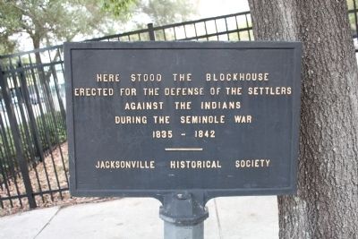
Seminole War Blockhouse Site
1835-1842
Erected by Jacksonville Historical Society.
Topics. This historical marker is listed in this topic list: Wars, US Indian.
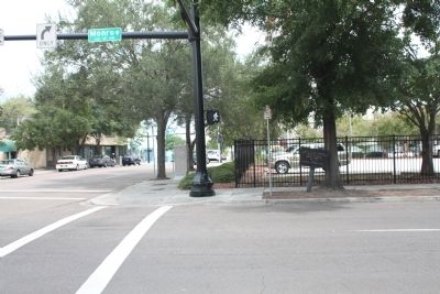
Location. 30° 19.695′ N, 81° 39.358′ W. Marker is in Jacksonville, Florida, in Duval County. It is in Urban Core. Marker is at the intersection of East Monroe Street and Ocean Street (U.S. 90), on the left when traveling east on East Monroe Street. Touch for map. Marker is in this post office area: Jacksonville FL 32202, United States of America. Touch for directions.
Other nearby markers. At least 8 other markers are within walking distance of this marker. Old Jacksonville Free Public Library (within shouting distance of this marker); Immaculate Conception Church - 1907 (about 300 feet away, measured in a direct line); "The Great Endurance Run" (about 300 feet away); Florida Pharmacy Association (about 400 feet away); The Carling Hotel (about 800 feet away); The Jacksonville Historical Society (approx. 0.2 miles away); The Florida Medical Assn (approx. 0.2 miles away); Jacksonville Public Library (approx. 0.2 miles away). Touch for a list and map of all markers in Jacksonville.
Credits. This page was last revised on February 3, 2023. It was originally submitted on December 1, 2013, by Tim Fillmon of Webster, Florida. This page has been viewed 977 times since then and 73 times this year. Photos: 1, 2. submitted on December 1, 2013, by Tim Fillmon of Webster, Florida. • Bernard Fisher was the editor who published this page.

