Idaho Falls in Bonneville County, Idaho — The American West (Mountains)
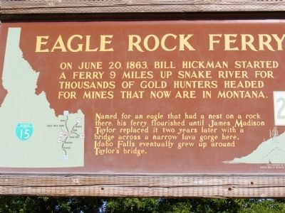
Eagle Rock Ferry
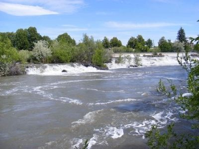
Named for an eagle that had a nest on a rock there, his ferry flourished until James Madison Taylor replaced it two years later with a bridge across a narrow lava gorge here. Idaho Falls eventually grew up around Taylor’s bridge.
Erected by Idaho Transportation Department. (Marker Number 224.)
Topics and series. This historical marker is listed in this topic list: Bridges & Viaducts. In addition, it is included in the Idaho State Historical Society series list. A significant historical month for this entry is June 1848.
Location. 43° 29.514′ N, 112° 2.634′ W. Marker is in Idaho Falls, Idaho, in Bonneville County. Marker is on South Capitol Avenue. Touch for map. Marker is in this post office area: Idaho Falls ID 83402, United States of America. Touch for directions.
Other nearby markers. At least 8 other markers are within walking distance of this marker. Taylor's Bridge (here, next to this marker); Eagle Rock Crossing (about 300 feet away, measured in a direct line); Farmers' and Merchants' Bank (approx. 0.2 miles away); The Odd Fellows (approx. 0.3 miles away); Prisoners of War in Idaho Falls (approx. 0.3 miles away); Snake River Bridge (approx. 0.3 miles away); Upper Snake River Valley Irrigation (approx. 0.4 miles away); Eagle Rock Meeting House (approx. 0.4 miles away). Touch for a list and map of all markers in Idaho Falls.
Credits. This page was last revised on June 16, 2016. It was originally submitted on December 4, 2013, by Don Morfe of Baltimore, Maryland. This page has been viewed 986 times since then and 36 times this year. Photos: 1, 2. submitted on December 4, 2013, by Don Morfe of Baltimore, Maryland. • Syd Whittle was the editor who published this page.
Editor’s want-list for this marker. Wide area view of the marker and its surroundings • Can you help?

