Bushmills in Causeway Coast and Glens, Northern Ireland, United Kingdom — Northwestern Europe (the British Isles)
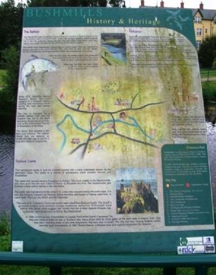
Bushmills History & Heritage
The Salmon
The natural life cycle of a salmon is one of nature's wonders. A salmon begins its life in the shallow water and gravel beds of the river as eggs then fry. These small fry stay in the river until they mature into par. The next stage of their life is when they mature into smolts and take on the colouring of the mature salmon.
The smolts move downstream around May or June to begin their epic migration to feeding grounds in the north Atlantic. Here, they feed on fish, such as capelin, herring and sand eel, which give salmon's flesh the characteristic pink colour.
Over the next year, the smolts mature into grilse and then make their way back to the rivers they came from to spawn and complete the cycle.
How they find their way back home is still one of the great mysteries of the natural world!
Since 1972, Bushmills Salmon Research Station has been engaged in a research project counting and monitoring smolts leaving the river and salmon returning.
The river is managed as a premier salmon river and the research has led to the Bush becoming recognised as an index river by the International Council for Exploration of the Seas.
The station also operates a fish farm and hatchery. The salmon reared here are released as smolts with data tags as part of a long term research programme.
Dunluce Castle
This spectacular castle is built on a basalt outcrop with a cave underneath, known as the Mermaid's Cave. The castle is a mixture of architecture, which includes Norman and Elizabethan.
The castle had several owners throughout its history. The most notable is the MacDonnells, who were given the title seat of Earl of Antrim by Elizabeth the First. The MacDonnells held Dunluce Castle until its decline in the mid 1600s.
The castle was inspirational to the writer C.S. Lewis who enjoyed visiting the north coast. It is said that Dunluce inspired Cair Paravel, where the King and Queen of Narnia ruled from, in Lewis' book, The Lion, the Witch, and the Wardrobe.
The ruins of St. Cuthbert's Church are a short walk from Dunluce Castle. The church's graveyard contains some wonderful heritage headstones, dating from 1610 onward. Local folklore tells stories which suggest that victims from the ill-fated Spanish Armada ship 'La Girona', were buried here by Sorley Boy MacDonnell.
In 1588, La Girona was shipwrecked on Lacada point at the Giant's Causeway. The ship was trying to make its way to Scotland after being driven back by fierce gales off the west coast of Ireland. Over 1200 men died, including crews of two other shipwrecks that were also on board. The ship was also carrying Spanish nobility and their
gold possessions. In 1967, Robert Stenuit, a Belgium diver and explorer, recovered this treasure.
Portcaman
Bushmills was originally known as Portcaman, a parish name dating back to the Norman period. Part of their power structure was to divide areas into deaneries and parish[es with?] a church.
In 1315, the military campaign of Edward the Bruce effectively ended Norman influence here and destroyed many parish churches. The bubonic plague which followed in 1348 killed half the population and devastated congregations which resulted in parishes amalgamation.
Portcaman and Dunluce became one parish, with a church at Dunluce village. After Dunluce Castle was abandoned, the population shifted back to the river Bush and its emerging water-powered industries.
Portcaman disappeared as a parish name after the disestablishment of the Church in 1870 and redefinition of boundaries.
The Diamond
The market square lies behind the clock tower. Weekly markets once took place here, and a linen market also opened in 1833.
Men, women and children would also find employment here at the Hiring Fair, held twice-yearly in May and November.
Millennium Park
Mo Mowlam, the Secretary of State for Northern Ireland, opened Millenium Park in 1999. The park was created as a Moyle District Council Millenium Project.
In 2008, the footbridge was created to link the village to the park. The Old Bushmills Whiskey Distillery made a contribution towards the construction of the bridge as part of the 400th anniversary celebrations of the Distillery.
Erected by Northern Ireland Tourist Board, Rural Development Council, EU Programme for Peace and Reconciliation, & Bushmills Distillery.
Topics. This historical marker is listed in these topic lists: Disasters • Environment • Industry & Commerce • Settlements & Settlers. A significant historical year for this entry is 1972.
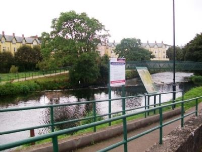
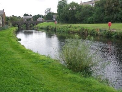
Location. 55° 12.304′ N, 6° 31.479′ W. Marker is in Bushmills, Northern Ireland, in Causeway Coast and Glens. The marker is along the River Bush, at the car park west of Main Street. Touch for map. Marker is at or near this postal address: 83 Main Street, Bushmills, Northern Ireland BT57 8QB, United Kingdom. Touch for directions.
Other nearby markers. At least 8 other markers are within 13 kilometers of this marker, measured as the crow flies. World Wars Memorial (about 120 meters away, measured in a direct line); Sgt. Robert Quigg (about 120 meters away); Giant’s Causeway and Bushmills Railway (about 180 meters away); Alphabet Angel (about 210 meters away); Hamill Terrace (approx. 0.4 kilometers away); Dunluce Castle (approx. 3.5 kilometers away); Dunseverick Castle (approx. 6 kilometers away); Carrick-a-Rede (approx. 12.8 kilometers away). Touch for a list and map of all markers in Bushmills.
Also see . . .
1. Bushmills. Wikipedia entry (Submitted on June 4, 2023, by Larry Gertner of New York, New York.)
2. Dunluce Castle. Medieval Britain website entry (Submitted on June 6, 2021, by Larry Gertner of New York, New York.)
Credits. This page was last revised on June 4, 2023. It was originally submitted on December 22, 2013, by William Fischer, Jr. of Scranton, Pennsylvania. This page has been viewed 799 times since then and 39 times this year. Photos: 1, 2. submitted on December 23, 2013, by William Fischer, Jr. of Scranton, Pennsylvania. 3. submitted on December 24, 2013, by William Fischer, Jr. of Scranton, Pennsylvania.


