Cartersville in Bartow County, Georgia — The American South (South Atlantic)
Rowland Springs
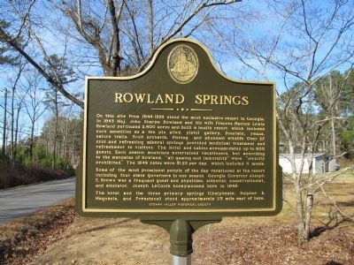
Photographed by Judith Barber, December 27, 2013
1. Rowland Springs Marker
Some of the most prominent people of the day vacationed at the resort including four state governors in one season. Georgia Governor Joseph E. Brown was a frequent guest and physician, scientist, conservationist, and educator. Joseph LeConte honeymooned here in 1846.
The hotel and the three primary springs (Chalybeate, Sulphur & Magnesia, and Freestone) stood approximately 1/3 mile east of here.
Erected by Etowah
this page online
Topics. This historical marker is listed in this topic list: Notable Places. A significant historical year for this entry is 1872.
Location. 34° 13.408′ N, 84° 44.509′ W. Marker is in Cartersville, Georgia, in Bartow County. It is at the intersection of Simpson Circle NE and Harvey Knight Road NE, on the right when traveling north on Simpson Circle NE. Touch for map. Marker is at or near this postal address: 295 Simpson Circle, Cartersville GA 30121, United States of America. Touch for directions.

Regionally, this marker is in Georgia’s Mountains. It is also in the American South and specifically in the Deep South. Globally, it is in North America, the Western Hemisphere, the Western World, and the Anglosphere. Historically, it finds itself in what was once the original Cherokee Nation, the territory of the Mississippian Culture, one of the original Thirteen Colonies, one of the Confederate States of America, and the Antebellum South.
Other nearby markers. At least 8 other markers are within 4 miles of this marker, measured as the crow flies: ca. 1960 Euclid Dump Truck (approx. 2 miles away);
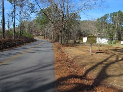
Photographed by Judith Barber, December 27, 2013
2. Rowland Springs Marker
Credits. This page was last revised on June 16, 2016. It was originally submitted on December 30, 2013, by Judith Barber of Marietta, Georgia. This page has been viewed 2,195 times since then and 92 times this year. Photos: 1, 2. submitted on December 30, 2013, by Judith Barber of Marietta, Georgia. • Bernard Fisher was the editor who published this page.
