Wheeling in Ohio County, West Virginia — The American South (Appalachia)
Fort Henry
"The Bloody Year of the Three Sevens"
— Wheeling National Heritage Area —
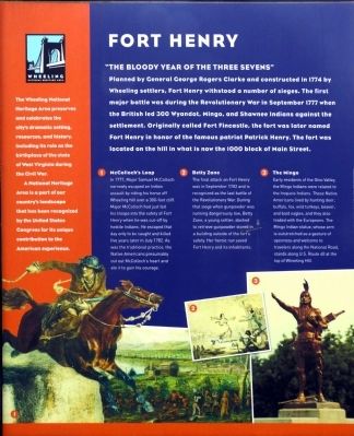
Planned by General George Rogers Clarke and constructed in 1774 by Wheeling settlers, Fort Henry withstood a number of sieges. The first major battle was during the Revolutionary War in September 1777 when the British led 300 Wyandot, Mingo, and Shawnee Indians against the settlement. Originally called Fort Fincastle, the fort was later named Fort Henry in honor of the famous patriot Patrick Henry. The fort was located on the hill in what is now the 1000 block of Main Street.
The Wheeling National Heritage Area preserves and celebrates the city's dramatic setting, resources, and history, including its role as the birthplace of the state of West Virginia during the Civil War.
A National Heritage Area is a part of our county's landscape that has been recognized by the United States Congress for its unique contribution to the American Experience.
[Captions:]
❶ In 1777, Major Samuel McColloch narrowly escaped an Indian assault by riding his horse off Wheeling hill over a 300-foot cliff. Major McColloch had just led his troops into the safety of Fort Henry when he was cut-off by hostile Indians. He escaped that day only to be caught and killed five years later in July 1782. As was the traditional practice, the Native Americans presumably cut out McCulloch's heart and ate it to gain his courage.
❷ The final attack on Fort Henry was September 1782 and is recognized as the last battle of the Revolutionary War. During that siege when gunpowder was running dangerously low, Betty Zane, a young settler, dashed to retrieve gunpowder stored in the a building outside of the fort's safety. Her heroic run saved Fort Henry and its inhabitants.
❸ Early residents of the Ohio Valley, the Mingo Indians were related to the Iroquois Indians. These Native Americans lived by hunting deer, buffalo, fox, wild turkeys, beaver, and bald eagles, and they also traded with the Europeans. The Mingo Indian statue, whose arm is outstretched as a gesture of openness and welcome to travelers along the National Road, stands along U.S. Route 40 at the top of Wheeling Hill.
Topics. This historical marker is listed in these topic lists: Forts and Castles • Settlements & Settlers • War, US Revolutionary. A significant historical month for this entry is September 1777.
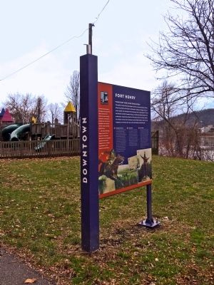
Location. 40° 4.159′ N, 80° 43.499′ W. Marker is in Wheeling, West Virginia, in Ohio County. Marker is on Wheeling Heritage Trail just south of 10th Street, on the right when traveling south. Marker is along the Wheeling Heritage Trail behind 1033 Main Street. Touch for map. Marker is at or near this postal address: 1039 Main St, Wheeling WV 26003, United States of America. Touch for directions.
Other nearby markers. At least 8 other markers
Credits. This page was last revised on April 24, 2022. It was originally submitted on January 4, 2014, by Allen C. Browne of Silver Spring, Maryland. This page has been viewed 1,294 times since then and 90 times this year. Last updated on January 7, 2014, by Allen C. Browne of Silver Spring, Maryland. Photos: 1. submitted on January 4, 2014, by Allen C. Browne of Silver Spring, Maryland. 2. submitted on April 24, 2022, by Devry Becker Jones of Washington, District of Columbia. 3. submitted on January 4, 2014, by Allen C. Browne of Silver Spring, Maryland. • Bill Pfingsten was the editor who published this page.

![Fort Henry Marker [Reverse]. Click for full size. Fort Henry Marker [Reverse] image. Click for full size.](Photos6/651/Photo651014.jpg?4242022113300AM)
