
Millbrook in Elmore County, Alabama — The American South (East South Central)
Robinson Springs Neighborhood
Photographed by Mark Hilton, January 8, 2014
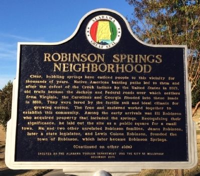
1. Robinson Springs Neighborhood Marker
Clear, bubbling springs have enticed people to this vicinity for thousands of years. Native American hunting paths led to them and after the defeat of the Creek Indians by the United States in 1813, old trails became the Jackson and Federal roads over which settlers from Virginia, the Carolinas and Georgia flooded into these lands in 1818. They were lured by the fertile soil and ideal climate for growing cotton. The free and enslaved worked together to establish this community. Among the early arrivals was Eli Robinson who acquired property that included the springs. Recognizing their significance, he laid out the site as a public square for a small town. He and two other unrelated Robinson families, James Robinson, later a state legislator, and Lewis Golson Robinson, founded the Town of Robinson, which later became Robinson Springs.
this page online
Erected 2010 by the Alabama Tourism Department and the City of Millbrook.
Topics and series. This historical marker is listed in these topic lists: Indigenous Peoples and Communities • Settlements & Settlers. In addition, it is included in the
Photographed by Mark Hilton, January 8, 2014
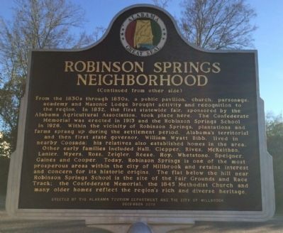
2. Robinson Springs Neighborhood Marker (reverse)
Location. 32° 30.834′ N, 86° 22.629′ W. Marker is in Millbrook, Alabama, in Elmore County. It is on Monument Drive 0.1 miles west of Main Street (Alabama Route 143), on the right when traveling west. Touch for map. Marker is at or near this postal address: 3631 Monument Drive, Millbrook AL 36054, United States of America. Touch for directions.

Regionally, this marker is in Alabama’s Tri-Counties River Region. It is also in the American South and specifically in the Deep South. Globally, it is in North America, a Gulf of Mexico state, the Western Hemisphere, the Western World, and the Anglosphere. Historically, it finds itself in what was once New Spain, the territory of the Mississippian Culture, one of the Confederate States of America, and the Antebellum South.
Other nearby markers. At least 8 other markers are within 6 miles of this marker, measured as the crow flies: Robinson Springs Camp Confederate Monument (about 400 feet away, measured in a direct line); Robinson Springs United Methodist Church (approx. 0.2 miles away);
Photographed by Mark Hilton, January 8, 2014
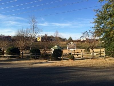
3. Robinson Springs Neighborhood
Credits. This page was last revised on June 16, 2016. It was originally submitted on January 8, 2014, by Mark Hilton of Montgomery, Alabama. This page has been viewed 2,472 times since then and 106 times this year. Photos: 1, 2, 3. submitted on January 8, 2014, by Mark Hilton of Montgomery, Alabama. • Bernard Fisher was the editor who published this page.
