East Peralta in Oakland in Alameda County, California — The American West (Pacific Coastal)
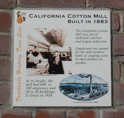
California Cotton Mill
Built in 1883
| — | Fruitvale History Tour Site | — |
Photographed by Barry Swackhamer, January 9, 2014
1. California Cotton Mill Marker
Captions: California Cotton Mill Workers, 1917(top): California Cotton Mill, 1886 (bottom).
Jingletown was named for the mill workers’ habit of jingling coins in their pockets on payday.
At its height, the mill had 600 to 700 employees and 20 to 30 buildings. I closed in 1956.
Topics. This historical marker is listed in this topic list: Industry & Commerce. A significant historical year for this entry is 1956.
Location. 37° 46.896′ N, 122° 14.266′ W. Marker is in Oakland, California, in Alameda County. It is in East Peralta. It is on Calcot Place, on the left when traveling north. Touch for map. Marker is at or near this postal address: 1091 Calcot Place, Oakland CA 94606, United States of America. Touch for directions.

Regionally, this marker is in California’s San Francisco Bay Area and on the Coast Ranges. It is also on the American Pacific Coast. Globally, it is in North America, on the Ring of Fire, on the Pacific Rim, in the Western Hemisphere, in the Western World, and in the Anglosphere. Historically, it finds itself in what was once New Spain and also Mexico’s Alta California.
Other nearby markers. At
this page online
Other markers no longer nearby. Early Harbor (was approx. 0.3 miles away but has been permanently removed); Church of St. James the Apostle (was approx. 0.8 miles away but has been confirmed missing).
Also see . . . California Cotton Mill - YouTube. This is a 7 minute film on the operation of the Calfornia Cotton Mill take in 1924. (Submitted on January 11, 2014, by Barry Swackhamer of Brentwood, California.)
Photographed by Barry Swackhamer, January 9, 2014
2. California Cotton Mill Marker
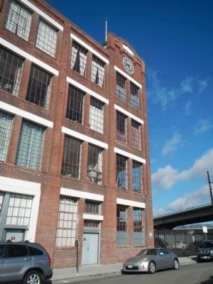
The marker is at the corner of the building.
Photographed by Barry Swackhamer, January 9, 2014
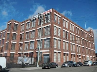
3. California Cotton Mill
Photographed by Barry Swackhamer, January 9, 2014
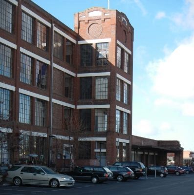
4. California Cotton Mill
Credits. This page was last revised on February 7, 2023. It was originally submitted on January 11, 2014, by Barry Swackhamer of Brentwood, California. This page has been viewed 1,667 times since then and 100 times this year. Photos: 1, 2, 3, 4. submitted on January 11, 2014, by Barry Swackhamer of Brentwood, California. • Bill Pfingsten was the editor who published this page.
