Produce and Waterfront in Oakland in Alameda County, California — The American West (Pacific Coastal)
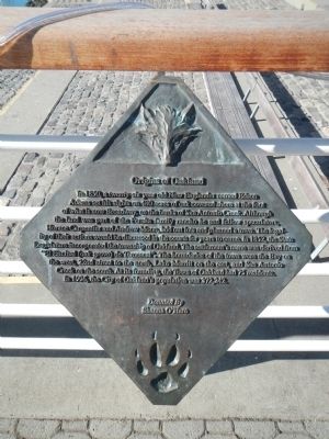
Origins of Oakland
In 1850, a twenty-six year old New Englander named Edson Adams set his sights on 480 acres of oak covered shore at the foot of what is now Broadway, on the banks of San Antonio Creek. Although the land was part of the Peralta family rancho he and fellow speculators, Horace Carpenter and Andrew Moon, laid out lots and planned a town. The legality of their actions would be discussed in the courts for years to come. In 1852 the State Legislature incorporated the township of Oakland. The settlement’s name was derived from “El Encinal (oak grove) de Temescal”. The boundaries of the town were the Bay on the west, 22nd street to the north, Lake Merritt on the east, and San Antonio Creek on the south. At its founding, the Town of Oakland has 75 residents. In 1996, the City of Oakland’s population was 373,242.
Shanna O’Hare
Erected by Port of Oakland.
Topics. This historical marker is listed in this topic list: Settlements & Settlers. A significant historical year for this entry is 1850.
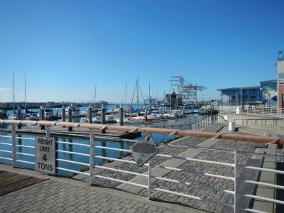
Location. 37° 47.655′ N, 122° 16.645′ W. Marker is in Oakland, California, in Alameda County. It is in Produce and Waterfront. Marker is on Broadway near Water Street. Touch for map. Marker is at or near this postal address: 2 Broadway, Oakland CA 94607, United States of America. Touch for directions.
Other nearby markers. At least 8 other markers are within walking distance of this marker. Pony Express Ferry “Oakland” (a few steps from this marker); Jack London (within shouting distance of this marker); Oakland's First Wharf (within shouting distance of this marker); Oakland Railroad History (about 300 feet away, measured in a direct line); Live Oak Lodge U.D (about 300 feet away); Jack London Square Development (about 500 feet away); Birthplace of Oakland (about 700 feet away); Evolution of a Marine Terminal (about 700 feet away). Touch for a list and map of all markers in Oakland.
More about this marker. This marker is located in Jack London Square. Jack London Square is closed to vehicular traffic.

Photographed By Larry Gertner
3. Welcome to the Oakland LocalWiki!
Website homepage for a work in progress
Click for more information.
Click for more information.
Credits. This page was last revised on February 7, 2023. It was originally submitted on January 13, 2014, by Barry Swackhamer of Brentwood, California. This page has been viewed 663 times since then and 22 times this year. Photos: 1, 2. submitted on January 13, 2014, by Barry Swackhamer of Brentwood, California. 3. submitted on May 20, 2021, by Larry Gertner of New York, New York. • Bill Pfingsten was the editor who published this page.

