Garrison in Putnam County, New York — The American Northeast (Mid-Atlantic)
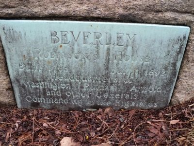
Beverley Robinson’s House
Photographed by Bill Coughlin, January 16, 2014
1. Beverley Robinson’s House Marker
Headquarters of
Washington, Putnam, Arnold
and other Generals
Commanding the Highlands.
Topics. This historical marker is listed in this topic list: War, US Revolutionary. A significant historical year for this entry is 1758.
Location. 41° 21.896′ N, 73° 56.985′ W. Marker is in Garrison, New York, in Putnam County. It is on Bear Mountain Beacon Hwy (New York State Route 9D) north of Lawes Lane, on the right when traveling north. Touch for map. Marker is in this post office area: Garrison NY 10524, United States of America. Touch for directions.

Regionally, this marker is in Upstate New York, specifically in the Hudson Valley, and in the New York City Metropolitan Area. It is also in the American Northeast, in the Mid-Atlantic, and on the Eastern Seaboard. Globally, it is in the North Atlantic Region, North America, the Western Hemisphere, the Western World, and the Anglosphere. Historically, it finds itself in what was once New Netherland and also one of the original Thirteen Colonies.
Other nearby markers. At least 8 other markers are within walking distance of this marker: Arnold’s Flight
this page online
Another marker is no longer nearby. Robinson House (was here, next to this marker but has been confirmed missing).
Photographed by Bill Coughlin, January 16, 2014
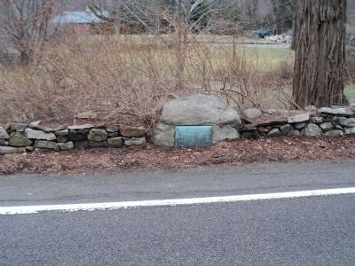
2. Beverley Robinson’s House Marker
Photographed by Bill Coughlin, January 16, 2014
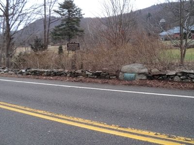
3. Site of the Beverley Robinson’s House
While in command at West Point, Gen. Benedict Arnold used the Beverly Robinson House as his headquarters. He was here when he learned that Maj. John Andre had been captured with plans he provided for capturing the fort, and escaped shortly before Gen. Washington arrived.
Credits. This page was last revised on June 16, 2016. It was originally submitted on January 16, 2014, by Bill Coughlin of Woodland Park, New Jersey. This page has been viewed 2,576 times since then and 199 times this year. Photos: 1, 2, 3. submitted on January 16, 2014, by Bill Coughlin of Woodland Park, New Jersey.
