Near New Hope in Madison County, Alabama — The American South (East South Central)
Walnut Grove Cumberland Presbyterian Church
Photographed by Lee Hattabaugh, January 19, 2014
1. Walnut Grove Cumberland Presbyterian Church Marker
Side A
Side A
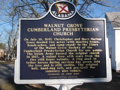
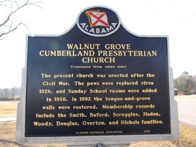
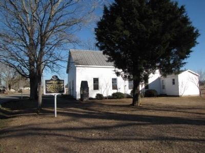
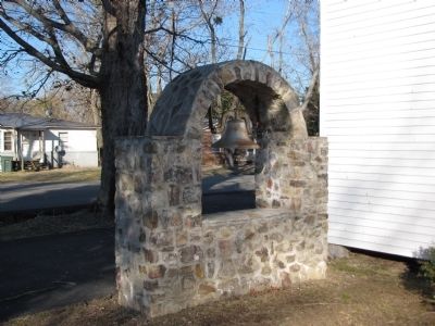
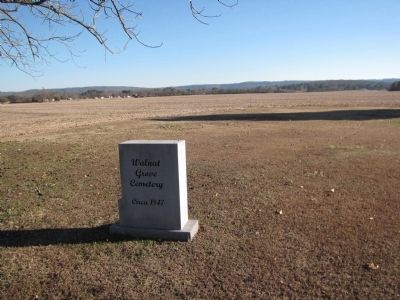
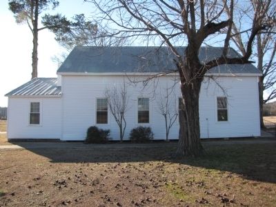
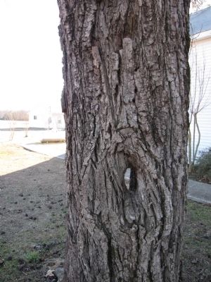
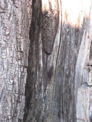
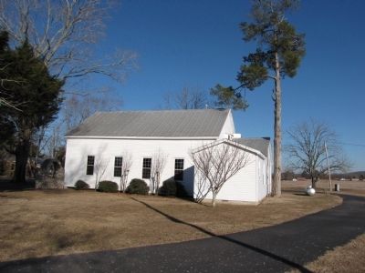
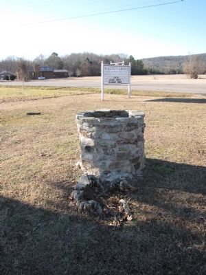
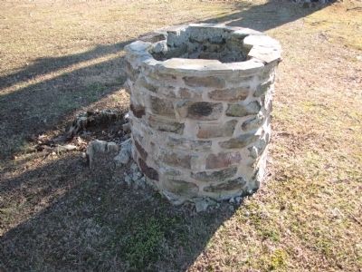
On July 19, 1847, Chistopher and Mary Harless Sears deeded two acres (with meeting house, brush-arbor, and camp-stand) to the Elders of the Walnut Grove Society of the Cumberland Presbyterian Church for one penny. The Union Army burned the original church in 1862. A walnut tree with scars from the fire still bears walnuts. A ring used to tether horses during services has grown into the tree and is still visible. The original bell, hand-dug well, and pre-Civil War cemetery also remain.
Erected 2007 by Alabama Historical Association.
Topics and series. This historical marker is listed in these topic lists: Religion & Religious Structures • Settlements & Settlers • War, US Civil. In addition, it is included in the Alabama Historical Association
this page online
Location. 34° 33.26′ N, 86° 22.574′ W. Marker is near New Hope, Alabama, in Madison County. It is at the intersection of New Hope Cedar Point Road and Cambron Road, on the right when traveling east on New Hope Cedar Point Road. Touch for map. Marker is at or near this postal address: 734 New Hope Cedar Point Road, New Hope AL 35760, United States of America. Touch for directions.

Regionally, this marker is in North Alabama and in the Huntsville Metropolitan Area. It is also in the American South, specifically in the Deep South, in Appalachia, and specifically in Southern Appalachia. Globally, it is in North America, a Gulf of Mexico state, the Western Hemisphere, the Western World, and the Anglosphere. Historically, it finds itself in what was once the original Cherokee Nation, the territory of the Mississippian Culture, one of the Confederate States of America, and the Antebellum South.
Other nearby markers. At least 8 other markers are within 5 miles of this marker, measured as the crow flies: Hayden Cemetery (approx. 1.1 miles away); Fort Deposit Trail (approx.
Photographed by Lee Hattabaugh, January 19, 2014
2. Walnut Grove Cumberland Presbyterian Church Marker
Side B
Photographed by Lee Hattabaugh, January 19, 2014
3. Walnut Grove Cumberland Presbyterian Church Marker
Photographed by Lee Hattabaugh, January 19, 2014
4. Church bell
Photographed by Lee Hattabaugh, January 19, 2014
5. Walnut Grove Cumberland Presbyterian Church cemetery
Photographed by Lee Hattabaugh, January 19, 2014
6. Walnut Grove Cumberland Presbyterian Church and the walnut tree
Photographed by Lee Hattabaugh, January 19, 2014
7. Walnut Tree
the place where the ring mentioned on the marker used to be.
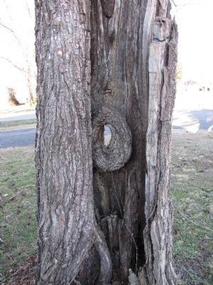
Photographed by Lee Hattabaugh, January 19, 2014
8. Walnut Tree
inside of the tree shows the burl where the ring used to be attached and, near the top, fire damage.
Photographed by Lee Hattabaugh, January 19, 2014
9. Walnut Tree
a better view of the fire damaged tree
Photographed by Lee Hattabaugh, January 19, 2014
10. Walnut Grove Cumberland Presbyterian Church
Photographed by Lee Hattabaugh, January 19, 2014
11. The Well
Photographed by Lee Hattabaugh, January 19, 2014
12. The Well
Credits. This page was last revised on June 16, 2016. It was originally submitted on January 19, 2014, by Lee Hattabaugh of Capshaw, Alabama. This page has been viewed 1,066 times since then and 54 times this year. Photos: 1, 2, 3, 4, 5, 6, 7, 8, 9, 10, 11, 12. submitted on January 19, 2014, by Lee Hattabaugh of Capshaw, Alabama. • Bernard Fisher was the editor who published this page.
