Near Dickerson in Montgomery County, Maryland — The American Northeast (Mid-Atlantic)
Springing Over the Monocacy / The Enduring Aqueduct
Chesapeake and Ohio Canal National Historical Park
— National Park Service, U.S. Department of the Interior —
Inscription.
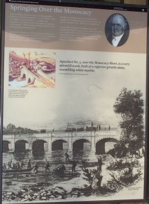
Springing Over the Monocacy
Captain William McNeill of the U.S. Topographical Engineers called this aqueduct “...a work which, while it is highly ornamental, unites...in its plan and execution, ‘the true principles of economy, usefulness and durability.’ ” Much of that durability was the result of its design and construction.
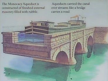
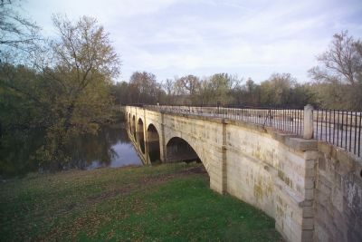
Building the Monocacy Aqueduct required four years, 200 men, and thousands of tons of cut stone. Benjamin Wright, the canal’s Chief Engineer, designed the aqueduct and oversaw its construction.
Dissatisfied with the early work on the 516-foot aqueduct, he had the first three piers torn down and rebuilt with better stone. By 1833 it was completed.
As originally designed, it would have been very ornamental. Wright’s specifications called for a careful use of white and red stone to create a beautiful yet functional structure. Although the red stone was not used, the beauty, economy, and durability of the Monocacy Aqueduct remain.
Aqueduct No. 2, over the Monocacy River, is a very splendid work, built of a superior granite stone, resembling white marble. Seventh Annual Report, C & O Canal Company, 1835.
(sidebar) Benjamin Wright (1770–1842) served as engineer on the Erie Canal before directing the construction of the Chesapeake & Ohio Canal. He is regarded as the father of American Civil Engineering.
The Enduring Aqueduct
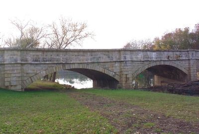
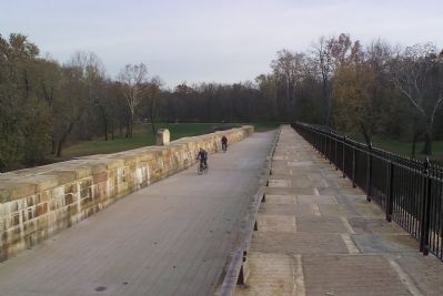
From 1833 until 1924 this aqueduct carried the C&O Canal over the Monocacy River. Thousands of boats, boatmen and mules, and millions of tons of coal and other cargo passed over this aqueduct. If you look closely you can see signs of their passage in wear marks on the stones and the iron rail posts.
The aqueduct endured despite nature's fury and man's best efforts. Floods roaring down the Monocacy washed ons of debris against the side of the aqueduct. Confederate troops tried twice to blow up the structure, failing both times.
Floods and changing technology eventually put an end to the C & O Canal Company and with it the boatman’s life. No longer part of an active transportation route, the Monocacy Aqueduct endures as a link to the past and a monument to the ambitions and hopes of those who built and worked on the C&O Canal.
The Monocacy Aqueduct, a work of very solid structure...withstood the extraordinary ice freshets of the last winter and spring... Fourth Annual Report, C & O Canal Company, 1832.
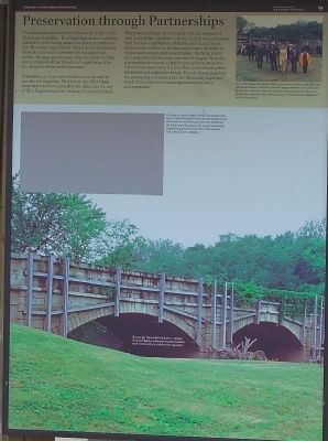
Preservation through Partnerships. Time, hard use, and the rivers all took their toll on the Monocacy Aqueduct. Its elegant appearance had been masked by steel braces installed to stabilize it after the 1972 Hurricana Agnes flood. Major floods and annual freshets continued to pummel the structure with debris. By 1994, seventy years after the canal had shut down, it appeared that floods and neglect would be the ruination of the stately structure.
Fortunately, an impressive coalition was formed to save the old aqueduct. First led by the C&O Canal Association and later joined by the American Society of Civil Engineers and the National Trust for Historic Preservation, the partnership grew with the support of First Lady Hillary Rodham-Clinton, United States Senators Paul Sarbanes and Barbara Mikulski and United States Representatives Roscoe Bartlett and Connie Morella, as well as state, country and local officials. Working under the leadership of Park Superintendent Douglas Faris, the partnership
developed a plan for preservation while the C&O Canal Association led the effort to raise both public awareness and restoration funds. It took eleven years but the partnership succeeded and the Monocacy Aqueduct stands today reborn for future generations to enjoy and appreciate.
(caption of missing photograph) On May 21, 2003, friends of the Chesapeake and Ohio Canal National Historical Park gathered on the banks of the Monocacy River to rededicate the Monocacy Aqueduct, the most oustanding engineering achievement of the Chesapeake and Ohio Canal Company.
Erected by National Park Service, U.S. Department of the Interior.
Topics and series. This historical marker is listed in these topic lists: Bridges & Viaducts • Landmarks • Waterways & Vessels. In addition, it is included in the ASCE Civil Engineering Landmarks, and the Chesapeake and Ohio (C&O) Canal series lists. A significant historical month for this entry is May 1987.
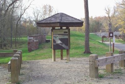
Location. 39° 13.248′ N, 77° 27.006′ W. Marker is near Dickerson, Maryland, in Montgomery County. Marker is on Mouth of Monocacy Road, 1.3 miles
west of Dickerson Road (Maryland Route 28), on the right when traveling west. Touch for map. Marker is at or near this postal address: 21000 Mouth of Monocacy Road, Dickerson MD 20842, United States of America. Touch for directions.
Other nearby markers. At least 5 other markers are within 2 miles of this marker, measured as the crow flies. Monocacy Aqueduct (about 800 feet away, measured in a direct line); Chesapeake and Ohio Aqueduct (approx. 1.3 miles away); Historic Site (approx. 1½ miles away); Linden Farm (approx. 1.6 miles away); 1862 Antietam Campaign (approx. 1.7 miles away). Touch for a list and map of all markers in Dickerson.
Also see . . . Benjamin Wright. Wikipedia entry (Submitted on February 25, 2022, by Larry Gertner of New York, New York.)
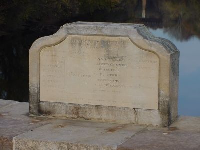
Photographed By J. J. Prats, November 4, 2006
10. Builder's Stone
The builder's stone is on the wall oposite the towpath, facing the towpath (see photo No. 9). The inscription reads Monocacy Aqueduct. Finished 1833. Ches. & Ohio Canal Co. C.F. Mercer, Pres't. J.J. Abert, W. Smith, P. Janney, A. Stewart, P. Lenox, W. Price; Directors. Engineers: Alfred Cruger, Principal; C.B. Fisk, Assistant; A.B. McFarlan, Inspector of Mansory. Contractors: M. Byrne, W. Byrne, S. Lothrop. P. Ingle, Clk. Clement Smith, Treasurer, Ches & Ohio Canal Co. On the bottom edge in small type are the words "Fred. Town," perhaps indicating that the inscription was carved in Frederick Town.
Credits. This page was last revised on February 25, 2022. It was originally submitted on November 24, 2006, by Tom Fuchs of Greenbelt, Maryland. This page has been viewed 5,875 times since then and 58 times this year. Photos: 1, 2, 3, 4, 5. submitted on November 24, 2006, by Tom Fuchs of Greenbelt, Maryland. 6. submitted on November 24, 2006. 7, 8, 9. submitted on November 24, 2006, by Tom Fuchs of Greenbelt, Maryland. 10. submitted on November 25, 2006, by J. J. Prats of Powell, Ohio. 11. submitted on November 25, 2006, by Tom Fuchs of Greenbelt, Maryland. 12. submitted on November 24, 2006, by Tom Fuchs of Greenbelt, Maryland. • J. J. Prats was the editor who published this page.
