Near Hope Hull in Montgomery County, Alabama — The American South (East South Central)
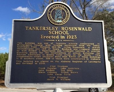
Tankersley Rosenwald School
Erected in 1923
Photographed by Mark Hilton, January 21, 2014
1. Tankersley Rosenwald School Marker
This building was placed on the Alabama Register of Landmarks and Heritage in 2001.
Frank Supples • Luke Anderson
John Sankey • Edd Dean
Simon Johnson • Arthur Brown
John Oscar Poole
First Principal
Jacob W. Williams
Erected by the Alabama Historical Commission.
Topics and series. This historical marker is listed in these topic lists: African Americans • Charity & Public Work • Education. In addition, it is included in the Alabama Historical Commission, and the Rosenwald Schools series lists. A significant historical year for this entry is 2001.
Location. 32° 8.539′ N,
this page online

Regionally, this marker is in the Tri-Counties River Region. It is also in the American South, specifically in the Deep South, and in the Black Belt. Globally, it is in North America, a Gulf of Mexico state, the Western Hemisphere, the Western World, and the Anglosphere. Historically, it finds itself in what was once the territory of the Mississippian Culture, one of the Confederate States of America, and the Antebellum South.
Other nearby markers. At least 8 other markers are within 4 miles of this marker, measured as the crow flies: Federal Road, 1805, (approx. 2.4 miles away); Pintlala Grange Hall / Grange Hall School (approx. 2½ miles away); Pintlala School (approx. 2½ miles away); William Bartram (approx. 2.7 miles away); The Federal Road / Manac's Tavern (approx. 3 miles
Photographed by Mark Hilton, January 21, 2014
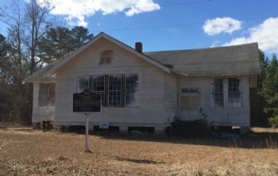
2. Old Tankersley Rosenwald School
Also see . . .
1. Tankersley Rosenwald School. Wikipedia entry. (Submitted on January 21, 2014, by Mark Hilton of Montgomery, Alabama.)
2. Rosenwald School. Wikipedia entry. (Submitted on January 21, 2014, by Mark Hilton of Montgomery, Alabama.)
3. Rosenwald Schools Initiative - Save Rosenwald Schools. National Trust for Historic Preservation (Submitted on January 22, 2014.)
Public Domain
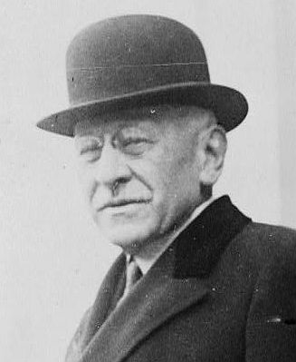
3. Julius Rosenwald
Credits. This page was last revised on January 30, 2018. It was originally submitted on January 21, 2014, by Mark Hilton of Montgomery, Alabama. This page has been viewed 2,207 times since then and 63 times this year. Photos: 1, 2, 3. submitted on January 21, 2014, by Mark Hilton of Montgomery, Alabama. • Bernard Fisher was the editor who published this page.
