Near Keedysville in Washington County, Maryland — The American Northeast (Mid-Atlantic)
Richardson's Division, Second Army Corps
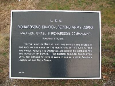
Richardson's Division, Second Army Corps,
Maj. Gen. Israel B. Richardson, Commanding.
September 15-17, 1862.
On the night of Sept. 15, 1862, the division was posted at the foot of the ridge on the north side of this road, to hold the bridge across the Antietam and secure the crossing for the movement of Sept. 16. The division occupied this position until the morning of Sept. 17, when it was relieved by Morell's Division of the Fifth Corps.
Erected by Antietam Battlefield Board. (Marker Number 34.)
Topics and series. This historical marker is listed in this topic list: War, US Civil. In addition, it is included in the Antietam Campaign War Department Markers series list. A significant historical month for this entry is September 1935.
Location. 39° 28.133′ N, 77° 42.978′ W. Marker is near Keedysville, Maryland, in Washington County. Marker is on Boonsboro / Shepherdstown Pike (State Highway 34), on the right when traveling west. Located in a tablet cluster on the east side of Antietam Creek along the Boonsboro Pike. Touch for map. Marker is at or near this postal address: 5522 Woodbury Walk, Keedysville MD 21756, United States of America. Touch for directions.
Other nearby markers. At least 8 other markers are within walking distance of this marker. Second Army Corps (here, next to this marker); Morell's Division, Fifth Army Corps (here, next to this marker); Humphreys' Division, Fifth Army Corps (here, next to this marker); Fifth Army Corps (within shouting distance of this marker); Army Headquarters (approx. half a mile away); Pry Family Upheaval (approx. half a mile away); a different marker also named Second Army Corps (approx. 0.6 miles away); The Newcomer House (approx. 0.7 miles away). Touch for a list and map of all markers in Keedysville.
Also see . . .
1. Antietam Battlefield. National Park Service site. (Submitted on April 15, 2008, by Craig Swain of Leesburg, Virginia.)
2. 1st Division, II Corps. General Richardson was possibly a descendant of Revolutionary War general Israel Putnam. (Submitted on April 15, 2008, by Craig Swain of Leesburg, Virginia.)
Photographed By Craig Swain
3. Reserve Position
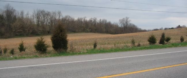
Looking northwest from the Boonsboro Pike, near the marker cluster. The ridge in the background stands on the east side of Antietam Creek north of the Middle Bridge, and shielded units deployed here from Confederate observation and fire. Three different divisions cycled through this location. On the morning of the 17th, Richardson's Division of the II Corps occupied positions here. Later in the day Morell's Division took position here as the center reserve. On the 18th Humphreys' Division arrived here.
Photographed By Craig Swain, February 9, 2008
4. Approaches to the Middle Bridge
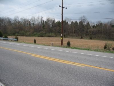
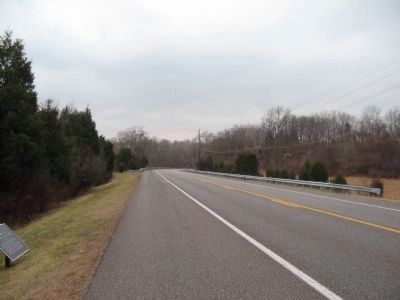
Richardson's Division was charged with controlling the approaches to the Middle Bridge on the day before the battle. Looking down Boonsboro Pike to the west toward the bridge, the Division used the road as it's left flank defending this section of the battlefield. On the lower left of the photo is a tablet for Fifth Corps, number 33, which stands on the opposite side of the road from the tablet cluster.
Photographed By Craig Swain
5. Marker Cluster East of Antietam Creek (before going missing).
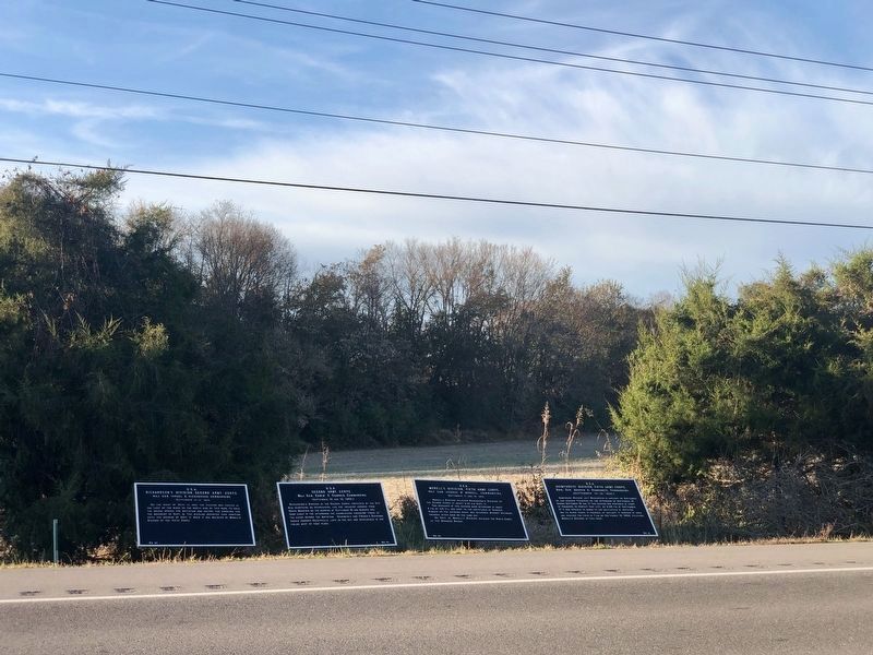
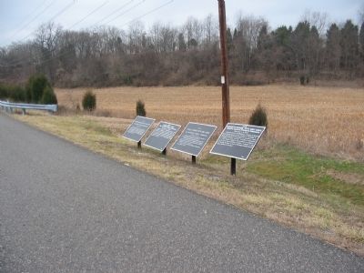
Federal marker cluster on the east side of Antietam Creek, along Boonsboro Pike. From left to right are Richardson's Division (Number 34), Second Army Corps (Number 35), Morell's Division (Number 26), and Humphreys' Division (Number 19).
Credits. This page was last revised on August 13, 2022. It was originally submitted on April 15, 2008, by Craig Swain of Leesburg, Virginia. This page has been viewed 943 times since then and 9 times this year. Photos: 1. submitted on April 15, 2008, by Craig Swain of Leesburg, Virginia. 2. submitted on November 10, 2021, by Jordan Butler of New Windsor, Maryland, USA. 3, 4, 5, 6. submitted on April 15, 2008, by Craig Swain of Leesburg, Virginia.
