Niagara Falls in Niagara County, New York — The American Northeast (Mid-Atlantic)
The Falls View Bridges
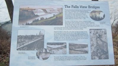
The first international bridge built near the falls was known as the Upper Suspension or New Suspension Bridge. When it was opened in 1869 with a 1,260-foot (384-meter) span, it was the longest suspension bridge ever constructed. The bridge was widened in 1888 to accommodate two-way traffic. On January 9, 1889, a strong southwest gale destroyed the bridge. It was quickly rebuilt and reopened on May 7, 1889.
The desire to have an electric railway crossing the gorge near the falls made it necessary to replace the Upper Suspension Bridge with a steel arch bridge. When the new bridge opened the following year, it became the world's longest single-span arch at 840 feet (256 meters). It was known as the Upper Steel Arch Bridge, International Railway Company Bridge, Falls View Bridge, and more popularly, the Honeymoon Bridge.
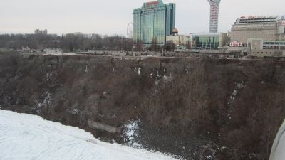
During the winter of 1937-1938, a very large and high ice bridge formed in the gorge and extended from the falls to Lake Ontario. On January 27, the ice pushed the bridge off its abutments. The bridge crumpled and fell onto the ice where it lay until the ice bridge broke up in April. Most of the wreckage sank where it had fallen, but some floated downriver on the ice and then sank. You can still see the concrete abutments near the bottom of the gorge, just upriver from the Rainbow Bridge.
The present Rainbow Bridge opened on November 1, 1941. Its abutments were built about 28 feet (8.53 meters) higher than those of the ill-fated Honeymoon Bridge to avoid problems with ice jams.
Upper Suspension Bridge, Courier and Ives lithograph, ca. 1870. Honeymoon Bridge prior to its collapse in 1938. Courtesy Niagara Falls Public Library. Honeymoon Bridge, 1937. Courtesy of Niagara Falls Convention and Visitors Bureau. This series of photographs shows the damage to the Honeymoon Bridge and its collapse on to the ice bridge.
Topics. This historical marker is listed in this topic list: Bridges & Viaducts. A significant historical year for this entry is 1869.
Location. 43° 5.319′ N, 79° 3.998′ W. Marker is in Niagara Falls, New York, in Niagara County. Marker can be reached from Prospect Street. Marker is located at the edge of the Niagara Gorge along a paved path in Niagara Reservation State Park, south of the Rainbow Bridge. The path ducks under the bridge apron north of the marker. Touch for map. Marker is in this post office area: Niagara Falls NY 14303, United States of America. Touch for directions.
Other nearby markers. At least 8 other markers are within walking distance of this marker. Bridges of Niagara (about 600 feet away, measured in a direct line); The First People to See the Falls (about 600 feet away); Hennepin View (about 600 feet away); Replica of the Statue of Liberty (approx. 0.2 miles away);
Height, Sight, and Flight / The Niagara River Corridor Important Bird Area (approx. 0.2 miles away); David Hill (approx. 0.2 miles away); Chief Clinton Rickard (approx. 0.2 miles away); Sophie Martin (approx. 0.2 miles away). Touch for a list and map of all markers in Niagara Falls.
Regarding The Falls View Bridges. The third and last owner of the Upper Steel Arch Bridge was the International Railway Company (IRC), which also owned the streetcar lines in Buffalo and the Niagara Gorge Railway.
The Falls View Bridges should not be confused with Roebling's suspension bridge, which was located at the present Whirlpool Rapids Bridge, also called the Lower Bridge (meaning further downstream - north).
Reference: Siebel, George A. Bridges Over the Niagara Gorge. Niagara Falls Bridge Commission, 1991. Information about Malcolm Allen may be found in a Niagara Gazette news article available in a scrapbook at the Niagara Falls (NY) Public Library, 3rd floor (local history materials).
Also see . . .
1. Honeymoon Bridge (Niagara Falls). Wikipedia entry (Submitted on January 30, 2014, by Anton Schwarzmueller of Wilson, New York.)
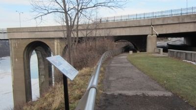
Photographed By Anton Schwarzmueller, January 9, 2014
3. The Falls View Bridges Marker
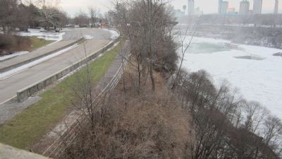
Northward view. Part of the decommissioned section of the Robert Moses Parkway ducks under the apron on the Rainbow Bridge. The apron was widened to accomodate the larger inspection structure that was opened in 1997, allowing for more inspection lanes.
2. Rainbow Bridge (Niagara Falls). Wikipedia entry (Submitted on January 30, 2014, by Anton Schwarzmueller of Wilson, New York.)
3. Niagara Falls Bridge Commission. Website homepage:
Traffic and toll information. Current owner of the Rainbow Bridge, Whirlpool Rapids Bridge, and Lewiston Queenston Bridge. The Commission was established jointly by the governments of The United States and Canada, having an equal number of Canadian and U.S. commissioners. (Submitted on January 30, 2014, by Anton Schwarzmueller of Wilson, New York.)
4. Western Hemisphere Travel Initiative. Homeland Security website entry:
Official border crossing document requirements for citizens and residents of Canada, The U.S., and Mexico. (Submitted on January 30, 2014, by Anton Schwarzmueller of Wilson, New York.)
5. Niagara Falls State Park. NYS Parks, Recreation and Historic Preservation website entry (Submitted on January 30, 2014, by Anton Schwarzmueller of Wilson, New York.)
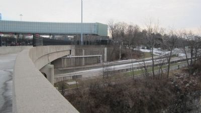
Photographed By Anton Schwarzmueller, January 16, 2014
5. View of Marker Pedestal from Bridge
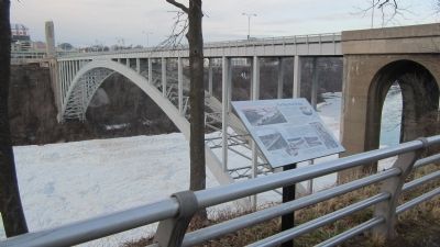
The back of the marker on a black pedestal is seen to the right where brush has been cleared between the pedestrian railing and the rim of the gorge. This picture is taken from the Rainbow Bridge pedestrian walkway at about the expansion joint to the bridge apron.
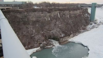
Photographed By Anton Schwarzmueller, January 16, 2014
6. View of Marker Pedestal and the Shoe and Abutment of Collapsed Bridge
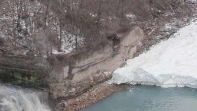
In this lowered angle view of the back of the marker pedestal from the Rainbow Bridge, the bank of the frozen Niagara River is shown with a steel shoe from the collapsed bridge still on the old abutment. The trailrace tunnel was directly under the earlier suspension bridge, making it necessary to locate the abutment for the Upper Steel Arch Bridge upstream. The American Falls is behind the viewing tower.
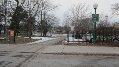
Photographed By Anton Schwarzmueller, January 16, 2014
10. To The Falls View Bridges Marker
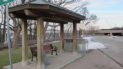
To reach the marker, walk this way from the sidewalk along the back edge of the Niagara Falls Reservation State Park parking lot to the Niagara Trolley stop deeper in this picture and then to the right along the paved gorge walking path, but not on the roadway.
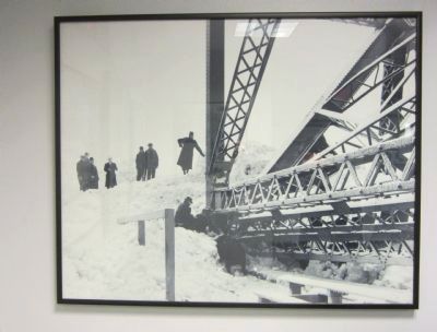
Photographed By Anton Schwarzmueller, January 25, 2014
11. Ice Pressing on the Bridge Footing
Note the steel bent by the pressure of the ice moving against the bridge footing. The effort to clear the ice from the footings on the U.S. side will be abandoned as futile, and a deathwatch begins. This picture hangs in the public immigration processing waiting room at the Rainbow Bridge, controlled by Customs and Border Protection, U.S. Department of Homeland Security.
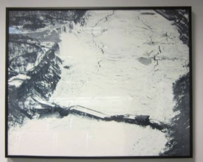
Photographed By Anton Schwarzmueller, January 25, 2014
12. The Collapsed Upper Steel Arch Bridge
The bridge was enticingly renamed the Honeymoon Bridge by newsmen AFTER the collapse. The American Falls are on the left. This picture hangs in the public immigration processing waiting room at the Rainbow Bridge; access controlled by Customs and Border Protection, U.S. Department of Homeland Security.
Photographed By Anton Schwarzmueller, January 25, 2014
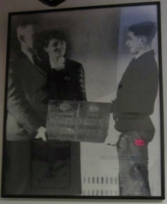
13. Malcom Allen
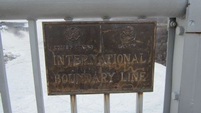
After the collapse of the bridge, men and boys climbed onto the ruins, taking pieces for momentos. Local paperboy Malcom Allen, age 15, took the international boundry plaque from the ruins. He stands in this picture with his parents and the plaque. This picture hangs in the public immigration processing waiting room at the Rainbow Bridge; access controlled by Customs and Border Protection, U.S. Department of Homeland Security.
Credits. This page was last revised on January 5, 2022. It was originally submitted on January 30, 2014, by Anton Schwarzmueller of Wilson, New York. This page has been viewed 993 times since then and 44 times this year. Photos: 1, 2, 3, 4, 5, 6, 7, 8, 9, 10, 11, 12, 13, 14. submitted on January 30, 2014, by Anton Schwarzmueller of Wilson, New York. • Bill Pfingsten was the editor who published this page.
