Mesa Verde National Park in Montezuma County, Colorado — The American Mountains (Southwest)
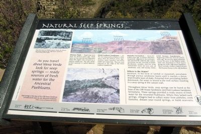
Natural Seep Springs
Where is the Water?
Moisture, in the form of rainfall or snowmelt, percolates through porous sandstone layers until it reaches a dense, impermeable layer of shale. Prevented from percolating farther downward, the water is forced to the rock surface resulting in a seep spring in the canyon wall.
Throughout Mesa Verde, seep springs can be found at the base of the Cliff House Sandstone and Point Lookout Sandstone formations. These springs provided a ready source of fresh water for the Ancestral Puebloans. Where they lacked such springs, villagers had to collect water from potholes, creek bottoms, distant year-round springs, or build reservoirs.
Mancos Shale – Beginning more than 90 million years ago, thick layers of clay and silt were deposited when this region was covered by a shallow inland sea. The soft, easily eroded material is called Mancos Shale.
Point Lookout Sandstone – As the sea temporarily withdrew a little more than 80 million years ago, shallow water beaches and delta sands were deposited. They are now exposed in the cliffs of the Point Lookout Sandstone.
Menefee Formation – About 80 million years ago, as marine shorelines temporarily migrated to the northeast, this area had the relatively flat surface of a former sea bed. Deposits in stream floodplains, swamps, and low lying interstream areas are now seen as sandstone, coal, and woody shales.
Cliff House Sandstones – Beginning a little less than 80 million years ago, the sea once again advanced across the area. In the shallow water, sand was deposited in thick layers giving rise to the Cliff House Sandstone. More recently, erosion created alcoves that became homes to the cliff dwellers.
(Upper Left Photo Caption)
New Fire House in Fewkes Canyon shows the alcoves and niches formed in the Cliff House Sandstone.
— Photo courtesy of Mary Griffits
(Lower Center Photo Caption)
Seep springs at the base of the Cliff House Sandstone provided fresh water for the Ancestral Puebloans.
— Photo courtesy of National Park Service
Erected by National Park Service.
Topics. This historical marker is listed in this topic list: Environment.
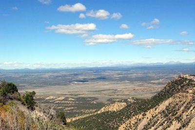
Location. 37° 16.661′ N, 108° 29.008′ W. Marker is in Mesa Verde National Park, Colorado, in Montezuma County. Marker can be reached from State Highway 10, 3 miles west of Moccasin Mesa Road, on the right when traveling west. Marker is located at the Geologic Overlook in Mesa Verde National Park. Touch for map. Marker is in this post office area: Mesa Verde National Park CO 81330, United States of America. Touch for directions.
Other nearby markers. At least 8 other markers are within 5 miles of this marker, measured as the crow flies. A Monument to Time (about 400 feet away, measured in a direct line); Montezuma Valley (approx. 2.7 miles away); Knife Edge... (approx. 2.7 miles away); Far View Reservoir (approx. 2.8 miles away); Prehistoric Mesa Verde Reservoirs (approx. 2.8 miles away); Mancos Valley (approx. 4.4 miles away); Water Technology (approx. 5 miles away); Greening the Valley (approx. 5 miles away). Touch for a list and map of all markers in Mesa Verde National Park.
Credits. This page was last revised on June 16, 2016. It was originally submitted on January 31, 2014, by Duane Hall of Abilene, Texas. This page has been viewed 617 times since then and 15 times this year. Photos: 1, 2. submitted on January 31, 2014, by Duane Hall of Abilene, Texas.
Editor’s want-list for this marker. Photo with wide-view of marker. • Can you help?

