Honolulu in Honolulu County, Hawaii — Hawaiian Island Archipelago (Pacific Ocean)
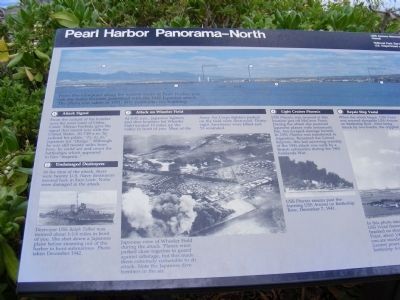
Pearl Harbor Panorama-North
USS Arizona Memorial
Inscription.
From this viewpoint along the eastern shore of Pearl Harbor you can see many features associated with the 1941 Japanese attack. The photo was taken in 1991, fifty years after the bombing.
1. Attack Signal-From the cockpit of his bomber over the west coast of Oahu, Cmdr Mitsuo Fuchida gave the signal that meant war with the United States. At 7:49 a.m. he radioed his pilots, “To, to, to,” Japanese for “charge.” Although he was still twenty miles from here, he could see and count the battleships which appeared to him “majestic.”
2. Undamaged Destroyers-At the time of the attack, there were twenty U.S. Navy destroyers moored here in East Loch. None were damaged in the attack.
(Inscription under the photo)
Destroyer USS Ralph Talbot was moored about 1-1/4 miles in front of you. She shot down a Japanese plane before steaming out of the harbor to hunt submarines. Photo taken December 1942.
3. At 8:02 a.m. Japanese fighters and dive bombers hit Wheeler Field located 10 miles up the valley in front of you. Most of the Army Air Corps fighters parked on the field were destroyed. Thirty-eight Americans were killed and 53 wounded.
(Inscription under the photo)
Japanese view of Wheeler Field during the attack. Planes were parked close together to guard against sabotage, but this made them extremely vulnerable to air attack. Note the Japanese dive bombers in the air.
4. Light Cruiser Phoenix-USS Phoenix was moored at this location just off McGrew Point. During the attack she pestered Japanese planes with antiaircraft fire, but escaped damage herself. In 1951 Phoenix was transferred to Argentina. Renamed the General Belgrano, this last surviving warship of the 1941 attack was sunk by a British submarine during the 1982 Falklands War.
(Inscription under the photo)
USS Phoenix steams past the burning USS Arizona on Battleship Row, December 7, 1941.
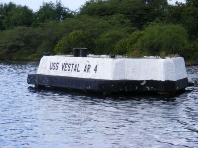
5. Repair Ship Vestal-When the attack began, USS Vestal was moored alongside USS Arizona on Battleship Row. After being struck by two bombs, the crippled ship was moved, with the assistance of two tugs, to this location off McGrew Point.
(Inscription under the photo)
In this photo taken December 7, USS Vestal (lower right) lies beached on shoals off McGrew Point, about ¼ mile from where you are standing. Black smoke (center) pours from the doomed battleship Arizona. Japanese A6M2 Model 21 “Zero” fighter planes strafed Americans aboard ships and on the ground.
6. North-The Japanese planes that attacked Pearl Harbor were launched from aircraft carriers located 230 miles to the north.
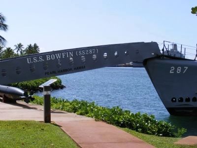
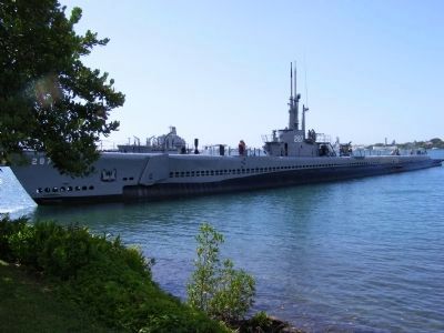
7. USS Bowfin-At the USS Bowfin Submarine Museum and Park
to your right, you may take a self-guided tour of a World War II era submarine. To reach the Bowfin, walk back through the National Park Service Visitor Center behind you, and turn left through the parking lot.
Erected by National Park Service-United States Department of the Interior.
Topics. This memorial is listed in this topic list: War, World II.
Location. 21° 22.018′ N, 157° 56.39′ W. Marker is in Honolulu, Hawaii, in Honolulu County. Memorial can be reached from Arizona Memorial Place. The marker is located on the Ceremonial Lawn of the USS Arizona Memorial which is a unit of the World War II Valor in the Pacific National Monument. Touch for map. Marker is in this post office area: Honolulu HI 96818, United States of America. Touch for directions.
Other nearby markers. At least 8 other markers are within walking distance of this marker. Pearl Harbor Panorama-West (here, next to this marker); Sunday Morning (a few steps from this marker); Bombers Over Battleship Row (a few steps from this marker); Island of Oahu (within shouting distance of this marker); Fall and Rise of the Fleet (within shouting distance of this marker); USS Arizona Anchor (about 300 feet away, measured in a direct line); The Lone Sailor (about 300 feet away); United States Marine Corps (about 400 feet away). Touch for a list and map of all markers in Honolulu.
Credits. This page was last revised on June 16, 2016. It was originally submitted on February 6, 2014, by Don Morfe of Baltimore, Maryland. This page has been viewed 765 times since then and 13 times this year. Photos: 1, 2, 3, 4, 5, 6. submitted on February 6, 2014, by Don Morfe of Baltimore, Maryland. • Bill Pfingsten was the editor who published this page.
