Near Lampasas in Lampasas County, Texas — The American South (West South Central)
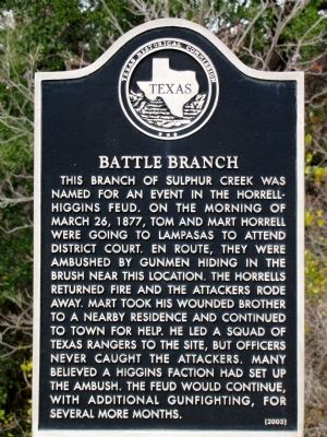
Battle Branch
Photographed by QuesterMark, December 1, 2013
1. Battle Branch Texas Historical Marker
Erected 2003 by Texas Historical Commission. (Marker Number 13134.)
Topics. This historical marker is listed in this topic list: Notable Events. A significant historical date for this entry is March 26, 1877.
Location. 31° 3.079′ N, 98° 5.816′ W. Marker is near Lampasas, Texas, in Lampasas County. It is on U.S. 190 0.2 miles east of County Route 86, on the right when traveling west. Touch for map. Marker is in this post office area: Lampasas TX 76550, United States of America. Touch for directions.

Regionally, this
this page online
Other nearby markers. At least 8 other markers are within 5 miles of this marker, measured as the crow flies: Hughes' Springs (approx. 3.6 miles away); First United Methodist Church (approx. 4.3 miles away); Lampasas Colored School (approx. 4.6 miles away); Cook Cemetery (approx. 4.7 miles away); Lampasas County (approx. 4.9 miles away); Lampasas County Courthouse (approx. 4.9 miles away); Lampasas County, C.S.A. (approx. 4.9 miles away); Hanna Springs (approx. 4.9 miles away). Touch for a list and map of all markers in Lampasas.
Additional keywords. water topics, duels, shoot-outs
Photographed by QuesterMark, December 1, 2013
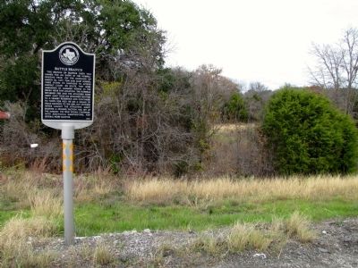
2. Battle Branch Marker vicinity
Credits. This page was last revised on June 16, 2016. It was originally submitted on February 7, 2014, by QuesterMark of Fort Worth, Texas. This page has been viewed 4,212 times since then and 247 times this year. Photos: 1, 2. submitted on February 7, 2014, by QuesterMark of Fort Worth, Texas. • Bernard Fisher was the editor who published this page.
