Atlas District in Northeast Washington in Washington, District of Columbia — The American Northeast (Mid-Atlantic)
The Hub
Hub, Home, Heart
— Greater H Street NE Heritage Trail —
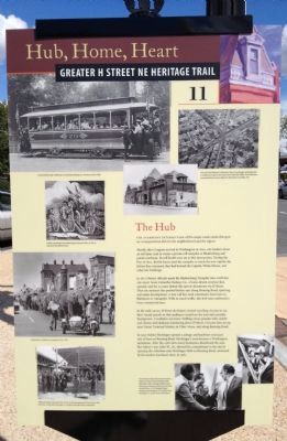
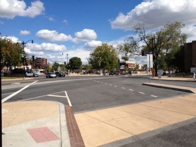
The starburst intersection of five major roads marks this spot as a transportation hub for the neighborhood and the region.
Shortly after Congress arrived in Washington in 1800, city leaders chose an old farm road to create a private toll turnpike to Bladensburg and points northeast. Its toll booth once sat at this intersection. During the War of 1812, British forces used the turnpike to reach the new capital city. Before they retreated, they had burned the Capitol, White House, and other key buildings.
In 1871 District officials made the Bladensburg Turnpike into a toll-free city street. Soon Columbia Railway Co., a horse-drawn streetcar line, opened, and for 30 years linked this spot to downtown via H Street. Then the streetcar line pushed farther east along Benning Road, spurring real estate development. A new rail line took commuters from here to Baltimore or Annapolis. With so much traffic, this hub soon anchored a busy commercial area.
In the early 1900s, H Street developers invited traveling circuses to use their vacant parcels so that audiences would see the area and consider buying here. A tradition was born: thrilling circus parades with camels and clowns and elephants lumbering down H Street. Circuses later set up near Union Terminal Market, in Uline Arena, and along Benning Road.
In 1930 Sidney Hechinger opened a salvage and hardware store just east of here on Benning Road. Hechinger's soon became a Washington institution. After the 1968 riots many businesses abandoned the area. But Sidney's son, John W., Sr., showed his commitment to the city by opening the suburban style Hechinger Mall on Benning Road, anchored by his modern hardware store, in 1981.
Erected 2012 by Cultural Tourism DC. (Marker Number 11.)
Topics and series. This historical marker is listed in these topic lists: Entertainment • Industry & Commerce • Roads & Vehicles • War of 1812. In addition, it is included in the Greater H Street Heritage Trail series list. A significant historical year for this entry is 1800.
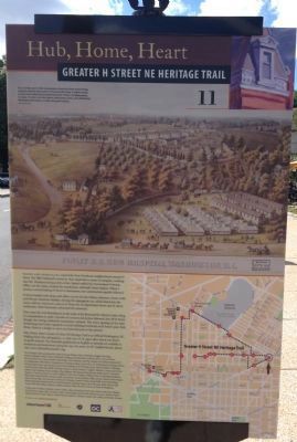
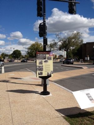
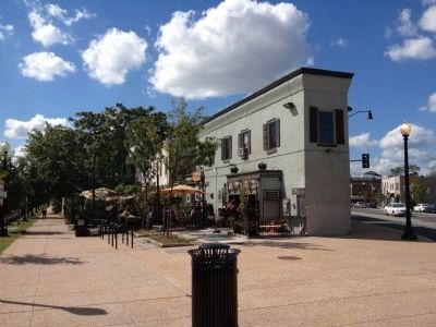
Location. 38° 54′ N, 76° 59.04′ W. Marker is in Northeast Washington in Washington, District of Columbia. It is in the Atlas District. Marker is at the intersection of H Street Northeast and Maryland Avenue Northeast (U.S. 1), on the right when traveling east on H Street Northeast. Touch for map. Marker is at or near this postal address: 1433 H Street Northeast, Washington DC 20002, United States of America. Touch for directions.
Other nearby markers. At least 8 other markers are within walking distance of this marker. Mediterranean Imports (approx. 0.2 miles away); District of Columbia Fire Department (approx. 0.2 miles away); Culture and Commerce (approx. 0.2 miles away); Enterprising Families (approx. ¼ mile away); Dr. Granville N. Moore (approx. ¼ mile away); Henrietta Vinton Davis Residence (approx. 0.3 miles away); Holyland Spiritual Temple (approx. 0.4 miles away); The Changing Faces of H Street (approx. 0.4 miles away). Touch for a list and map of all markers in Northeast Washington.
Credits. This page was last revised on January 30, 2023. It was originally submitted on September 30, 2012, by Craig Swain of Leesburg, Virginia. This page has been viewed 731 times since then and 40 times this year. Last updated on February 11, 2014, by A. Taylor of Laurel, Maryland. Photos: 1, 2, 3, 4, 5. submitted on September 30, 2012, by Craig Swain of Leesburg, Virginia. • Bill Pfingsten was the editor who published this page.
