Near Imnaha in Wallowa County, Oregon — The American West (Northwest)
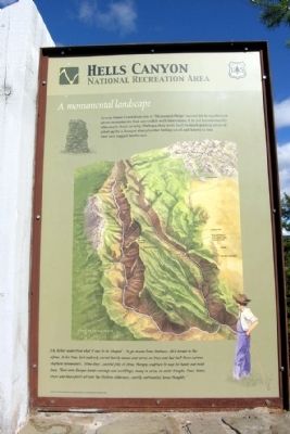
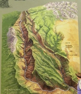
A Monumental Landscape
Hells Canyon National Recreation Area
”My father understood what it was to be ‘sheeped’ – to go insane from lonliness...He’d herded in the alpine...In his time, he’d endlessly carved family names and verses on trees and had built those curious sheperd monuments...‘stoneboys’...careful piles of stone, therapy sculpture to keep his hands and mind busy. There were Basque herder carvings and scribblings, many in verse, on water troughs, trees, tanks, rocks and fence posts all over the Western wildnerness...mostly sentimental home thoughts.”
Quote from “A Shepherd Watches, a Shepherd Sings”, by Louis Irigaray and Theodore Taylor
Erected by United States Forest Service.
Topics. This historical marker is listed in this topic list: Agriculture.
Location. 45° 28.639′ N, 116° 44.932′ W. Marker is near Imnaha, Oregon, in Wallowa County. Marker is on Hat Point Road, on the left when traveling south. Hat Point Road begins in Imnaha; marker is located at the Horse Creek Overlook interpretive site in Hells Canyon National Recreation Area approximately 11 miles from Imnaha. Touch for map. Marker is in this post office area: Imnaha OR 97842, United States of America. Touch for directions.
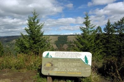
Other nearby markers. At least 3 other markers are within 10 miles of this marker, measured as the crow flies. Horse Creek Overlook (here, next to this marker); The Nez Perce War of 1877 (approx. 7 miles away); The Imnaha Canyon ... shelter and sanctuary (approx. 9.3 miles away).
Credits. This page was last revised on June 16, 2016. It was originally submitted on February 14, 2014, by Duane Hall of Abilene, Texas. This page has been viewed 412 times since then and 15 times this year. Photos: 1, 2, 3. submitted on February 14, 2014, by Duane Hall of Abilene, Texas.
Editor’s want-list for this marker. Photo of wide-view of marker and surroundings. Photo of clear view of Monument Ridge. • Can you help?


