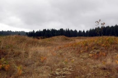
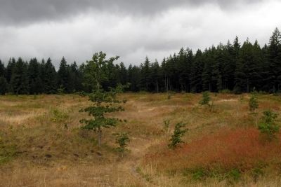
Near Littlerock in Thurston County, Washington — The American West (Northwest)
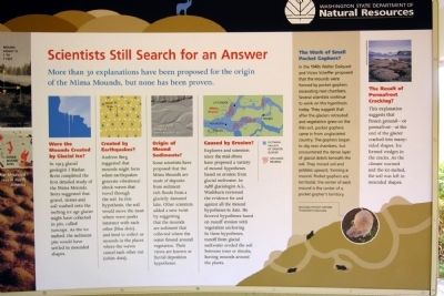
Scientists Still Search for an Answer
Were the Mounds Created by Glacial Ice?
In 1913 glacial geologist J Harlan Bretz completed the first detailed study of the Mima Mounds. Bretz suggested that gravel, stones and soil washed onto the melting ice age glacier might have collected in pits, called suncups. As the ice melted, the sediment pits would have settled in mounded shapes.
Created by Earthquakes?
Andrew Berg suggested that mounds might form when earthquakes generate vibrational shock waves that travel through the soil. In this hypothesis, the soil would move the most where wave peaks intersect with each other (blue dots), and tend to collect as mounds in the places where the waves cancel each other out (white dots).
Origin of Mound Sediments?
Some scientists have proposed that the Mima Mounds are made of deposits from sediment rich floods from a glacially dammed lake. Other scientists added a new twist by suggesting that the mounds are sediment that collected where the water flowed around vegetation. Their views are known as fluvial deposition hypotheses.
Caused by Erosion?
Explorers and scientists since the mid-1800s have proposed a variety of mound hypotheses based on erosion from glacial meltwater. In 1988 glaciologist A.L. Washburn reviewed the evidence for and against all the mound hypotheses to date. He favored hypotheses based on runoff erosion with vegetation anchoring. In these hypotheses, runoff from glacial meltwater eroded the soil between trees or shrubs, leaving mounds around the plants.
The Work of Small Pocket Gophers?
In the 1940s Walter Dalquest and Victor Scheffer proposed that the mounds were formed by pocket gophers excavating nest chambers. Several scientists continue to work on this hypothesis today. They suggest that after the glaciers retreated and vegetation grew on the thin soil, pocket gophers came in from unglaciated country. The gophers began to dig nest chambers, but encountered the dense layer of glacial debris beneath the soil. They moved soil and pebbles upward, forming a mound. Pocket gophers are territorial; the center of each mound is the center of a pocket gopher’s territory.
The Result of Permafrost Cracking?
This explanation suggests that frozen ground—or permafrost—at the end of the glacier cracked into many-sided shapes. Ice formed wedges in the cracks. As the climate warmed and the ice melted, the soil was left in mounded shapes.
Erected by Washington State Department of Natural Resources.
Topics. This historical marker is listed in this topic list: Natural Features.
Location. 46° 54.272′ N, 123° 2.918′ W. Marker is near Littlerock, Washington, in Thurston County. Marker can be reached from Waddell Creek Road SW, 0.4 miles south of Deer Tail Road SW. Marker is located in Mima Mounds Natural Area Preserve in a kiosk that is a short walk from the parking lot; the above directions are to the intersection of Waddell Creek Road SW and the driveway to the Mima Mounds parking lot. Touch for map. Marker is in this post office area: Littlerock WA 98556, United States of America. Touch for directions.
Other nearby markers. At least 8 other markers are within 11 miles of this marker, measured as the crow flies. What We Know for Sure (here, next to this marker); Mima Mounds: A Special Prairie (here, next to this marker); Mima Mounds: The Mysterious Work of Nature (here, next to this marker); Ecological Connections (here, next to this marker); They're voting! (approx. 1.6 miles away); Oregon Trail (approx. 8.3 miles away); Oregon Trail 1844 (approx. 10 miles away); Crosby House (approx. 10˝ miles away). Touch for a list and map of all markers in Littlerock.
Credits. This page was last revised on October 14, 2020. It was originally submitted on February 16, 2014, by Duane Hall of Abilene, Texas. This page has been viewed 422 times since then and 6 times this year. Photos: 1. submitted on February 16, 2014, by Duane Hall of Abilene, Texas. 2, 3. submitted on February 15, 2014, by Duane Hall of Abilene, Texas.
Editor’s want-list for this marker. Photo of wide-view of marker and surroundings. • Can you help?


