Near Avon in Powell County, Montana — The American West (Mountains)
The Valley of a Thousand Haystacks
Photographed by Duane Hall, August 8, 2010
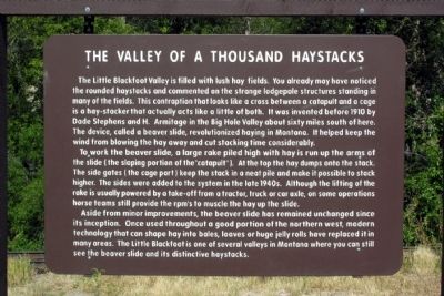
1. The Valley of a Thousand Haystacks Marker
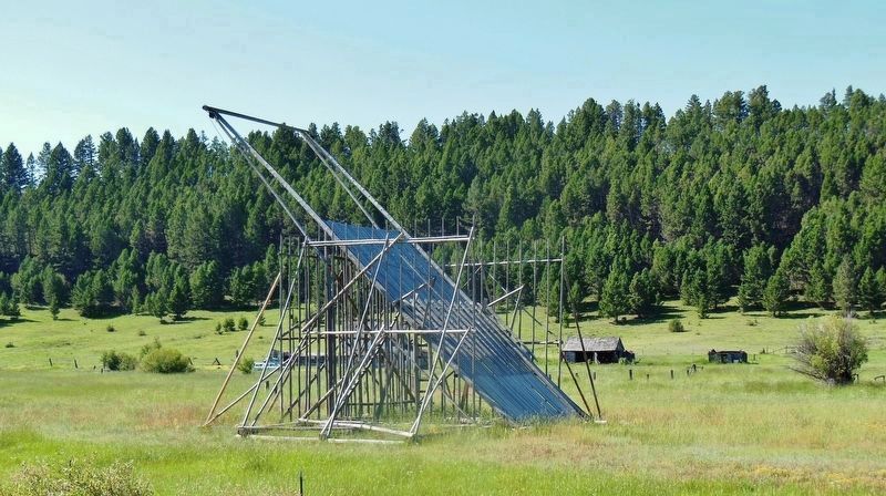
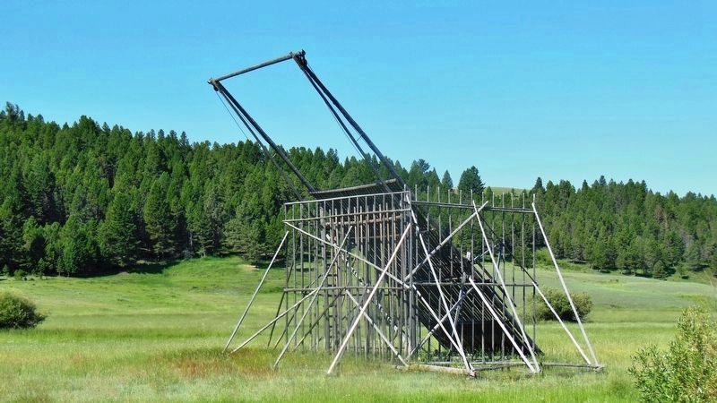
The Little Blackfoot Valley is filled with lush hay fields. You already may have noticed the rounded haystacks and commented on the strange lodgepole structures standing in many of the fields. This contraption that looks like a cross between a catapult and a cage is a hay-stacker that actually acts like a little of both. It was invented before 1910 by Dade Stephens and H. Armitage in the Big Hole Valley about sixty miles south of here. The device, called a beaver slide, revolutionized haying in Montana. It helped keep the wind from blowing the hay away and cut stacking time considerably.
To work the beaver slide, a large rake piled high with hay is run up the arms of the slide (the sloping portion of the “catapult”). At the top the hay dumps onto the stack. The side gates (the cage part) keep the stack in a neat pile and make it possible to stack higher. The sides were added to the system in the late 1940s. Although the lifting of the rake is usually powered by a take-off from a tractor, truck or car axle, on some operations horse teams still provide the rpm’s to muscle the hay up the slide.
Aside from minor improvements,
this page online
Topics. This historical marker is listed in these topic lists: Agriculture • Natural Features • Natural Resources. A significant historical year for this entry is 1910.
Location. 46° 35.462′ N, 112° 39.424′ W. Marker is near Avon, Montana, in Powell County. It is on U.S. 12 1½ miles west of Chokecherry Lane, on the right when traveling west. Touch for map. Marker is in this post office area: Avon MT 59713, United States of America. Touch for directions.

Regionally, this marker is in andspecifically outhwest Montana, in Gold West Country, in Mining Country. It is also in the American Mountain West and in the Lewis & Clark Corridor. Globally, it is in North America, the Rocky Mountains, the Western Hemisphere, the Western World, and the Anglosphere. Historically, it
Photographed by Cosmos Mariner, July 10, 2013
2. The Valley of a Thousand Haystacks Marker (wide view)
Other nearby markers. At least 8 other markers are within 14 miles of this marker, measured as the crow flies: Site of the First Log House in the Deer Lodge Valley (approx. 8.2 miles away); Ranching Traditions - A New Generation (approx. 13.2 miles away); From Range to Market (approx. 13.2 miles away); Vaquero vs. Cowboy (approx. 13.2 miles away); The Long and Short of Cattle Breeds (approx. 13.2 miles away); Equal in the Saddle (approx. 13.2 miles away); Winter of 1886 (approx. 13.2 miles away); Two Immigrants Shared an American Dream (approx. 13.2 miles away).
Photographed by Google Street View (©2014 Google), June 2012
3. The Valley of a Thousand Haystacks Marker
Photographed by Cosmos Mariner, July 10, 2013
4. Rustic Hay-Stacker / Beaver Slide (located in field near marker)
Photographed by Cosmos Mariner, July 10, 2013
5. Rustic Hay-Stacker / Beaver Slide (located in field near marker)
Credits. This page was last revised on July 13, 2026. It was originally submitted on February 23, 2014, by Duane Hall of Abilene, Texas. This page has been viewed 6,522 times since then and 328 times this year. Last updated on July 12, 2026, by Jimmy Emerson of Dalton, Georgia. Photos: 1. submitted on February 23, 2014, by Duane Hall of Abilene, Texas. 2. submitted on December 23, 2018, by Cosmos Mariner of Cape Canaveral, Florida. 3. submitted on February 23, 2014, by Duane Hall of Abilene, Texas. 4, 5. submitted on December 23, 2018, by Cosmos Mariner of Cape Canaveral, Florida. • Devry Becker Jones was the editor who published this page.
