Ellicott City in Howard County, Maryland — The American Northeast (Mid-Atlantic)
Road Versus Rails
The Rivalry Begins
— The Historic National Road - The Road That Built The Nation —
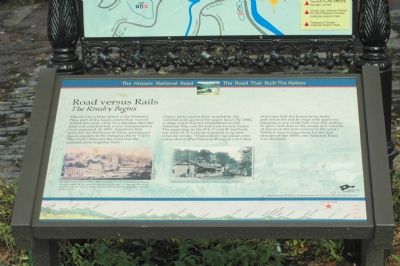
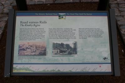
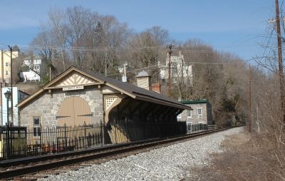
Ellicott City’s Main Street is the National Pike, part of the road system that moved Americans west. Only two decades after the road was constructed, a new transportation rival appeared. In 1831, America’s first railroad, the Baltimore & Ohio, introduced steam engines to the Patapsco River Valley. The rivalry between the road and the railroad came together here.
Noisy, dirty, and at first, unreliable, the railroad soon gained the upper hand. By 1840, a stage coach trip to Cumberland on the National Pike cost $9 and took twenty hours. The same trip on the B & O cost $7 and took ten. John H. B. Latrobe summed it up best when he wrote, “That solitary horseman who comes down [the National Road] at a trot that dislocates half the bones in his body, and sends his saddle bags with grievous flapping is one of the few who still prefers its glow and dust to the shade and velocity of travel on the iron avenue to the west.” While it was so important for the first decades of the 1800s, the National Road was doomed.
[Caption:]
An 1832 traveler observed that “Ellicott’s Mills is at the intersection of rail and turnpike roads; the two great thoroughfares to the west. We have the pleasure of observing the slow paced vehicles passing below us and the rapid easy movement of the railcars.”
Erected by America's Byways.
Topics and series. This historical marker is listed in these topic lists: Industry & Commerce • Railroads & Streetcars • Roads & Vehicles. In addition, it is included in the Baltimore and Ohio Railroad (B&O), and the The Historic National Road series lists. A significant historical year for this entry is 1831.
Location. This marker has been replaced by another marker nearby. It was located near 39° 16.067′ N, 76° 47.7′ W. Marker was in Ellicott City, Maryland, in Howard County. Marker could be reached from the intersection of Maryland Avenue and Main Street (Maryland Route 144). Marker was at the B&O Railroad Museum at the Ellicott City Station. Touch for map. Marker was in this post office area: Ellicott City MD 21043, United States of America. Touch for directions.
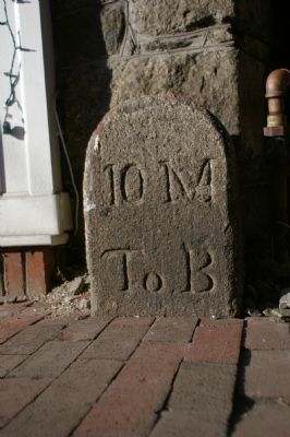
Other nearby markers. At least 5 other markers are within walking distance of this location. Roads versus Rails (here, next to this marker); The Patapsco Hotel (a few steps from this marker); Baltimore and Frederick Turnpike Milestone (a few steps from this marker); B&O Railroad Station (a few steps from this marker); To Preserve the Union (within shouting distance of this marker). Touch for a list and map of all markers in Ellicott City.
Related marker. Click here for another marker that is related to this marker. This marker has been replaced with the linked marker.
Also see . . .
1. Impossible Challenge: the Baltimore and Ohio Railroad in Maryland. (Submitted on May 5, 2008, by Tom Fuchs of Greenbelt, Maryland.)
2. Impossible Challenge II: Baltimore to Washington and Harpers Ferry from 1828 to 1994. (Submitted on May 5, 2008, by Tom Fuchs of Greenbelt, Maryland.)
Credits. This page was last revised on March 24, 2024. It was originally submitted on November 28, 2006, by Tom Fuchs of Greenbelt, Maryland. This page has been viewed 2,590 times since then and 50 times this year. Photos: 1. submitted on November 28, 2006, by Tom Fuchs of Greenbelt, Maryland. 2. submitted on September 17, 2007, by Tom Fuchs of Greenbelt, Maryland. 3, 4. submitted on March 1, 2008, by Christopher Busta-Peck of Shaker Heights, Ohio. 5. submitted on March 17, 2006, by Tom Fuchs of Greenbelt, Maryland. 6. submitted on January 23, 2008, by Christopher Busta-Peck of Shaker Heights, Ohio. • J. J. Prats was the editor who published this page.
