Laurel in Prince George's County, Maryland — The American Northeast (Mid-Atlantic)
Avondale Mill: A Lost Treasure
Riverfront Park Heritage & Nature Trail
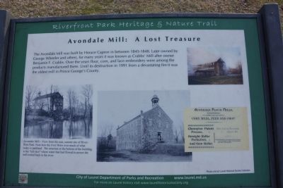
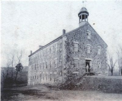
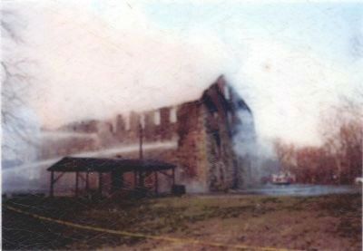
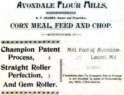
The Avondale Mill was built by Horace Capron in between 1845-1848. Later owned by George Wheeler and others, for many years it was known as Crabbs' Mill after owner Benjamin F. Crabbs. Over the years flour, corn, and lace embroidery were among the products manufactured there. Until its destruction in 1991 from a devastating fire it was the oldest mill in Prince George's County.
Erected by City of Laurel.
Topics. This historical marker is listed in this topic list: Industry & Commerce. A significant historical year for this entry is 1991.
Location. 39° 6.448′ N, 76° 50.742′ W. Marker is in Laurel, Maryland, in Prince George's County. The marker is in Laurel's Riverfront Park Heritage & Nature Trail, just south of the Patuxent River. There is a parking lot at the north end of 4th and Avondale Streets, and the marker is in that section of the park. Touch for map. Marker is in this post office area: Laurel MD 20707, United States of America. Touch for directions.
Other nearby markers. At least 8 other markers are within walking distance of this marker. Riverfront Park (a few steps from this marker); Patuxent River (within shouting distance of this marker); Avondale Mill (within shouting distance of this marker); Site of Laurel's Civil War Hospital (about 800 feet away, measured in a direct line); An Angel Among US (approx. 0.2 miles away); First United Methodist Church of Laurel (approx. 0.2 miles away); Laurel: Half-way between Baltimore and Washington (approx. 0.2 miles away); A “Little Dam” Powers the Avondale Mill (approx. ¼ mile away). Touch for a list and map of all markers in Laurel.
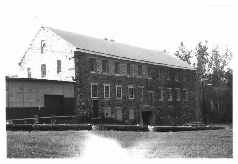
via NPS, unknown
2. Avondale Mill aka Crabb's Mill
National Register of Historic Places Nomination Form:
NPGallery Digital Asset Management System
Click for more information.
NPGallery Digital Asset Management System
Click for more information.
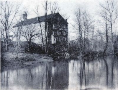
Photographed By Allen C. Browne, November 15, 2014
3. Avondale Mill
View from rear, current site of Riverfront Park. Note how the river flows over much what is today parkland. The structure at the bottom of the building is the "tail race" where water that flowed to power the mill exited back into the river.
Close-up of photo on marker
Credits. This page was last revised on September 6, 2023. It was originally submitted on March 3, 2014, by A. Taylor of Laurel, Maryland. This page has been viewed 601 times since then and 27 times this year. Photos: 1. submitted on March 3, 2014, by A. Taylor of Laurel, Maryland. 2. submitted on September 6, 2023, by Larry Gertner of New York, New York. 3, 4, 5, 6. submitted on November 18, 2014, by Allen C. Browne of Silver Spring, Maryland. 7. submitted on March 3, 2014, by A. Taylor of Laurel, Maryland. • Bill Pfingsten was the editor who published this page.
