The Palisades in Northwest Washington in Washington, District of Columbia — The American Northeast (Mid-Atlantic)
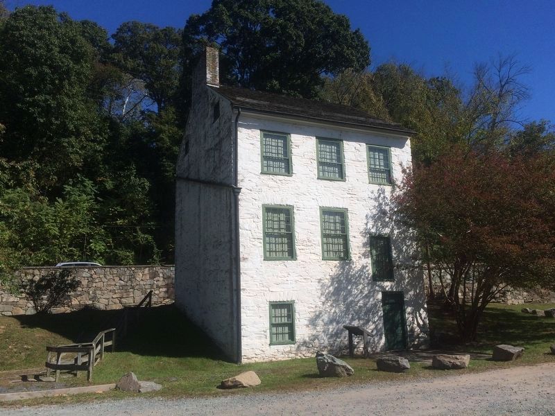
Abner Cloud House
Chesapeake and Ohio Canal National Historical Park
— National Park Service, U.S. Department of the Interior —
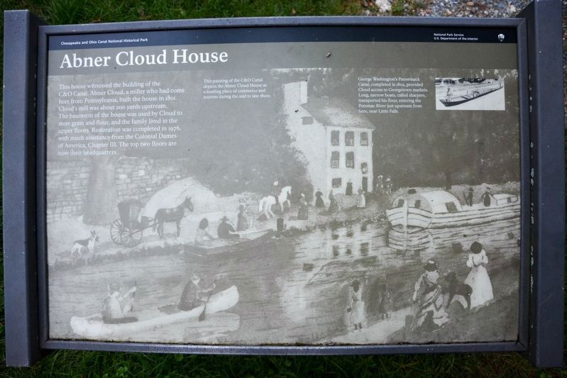
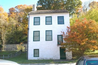
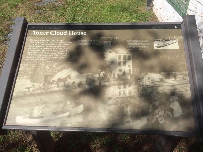
This house witnessed the building of the C&O Canal. Abner Cloud, a miller who had come here from Pennsylvania, built the house in 1801. Cloud's mill was about 200 yards upstream. The basement of the house was used by Cloud to store grain and flour, and the family lived in the upper floors. Restoration was completed in 1976, with much assistance from the Colonial Dames of America, Chapter III. The top two floors are now their headquarters.
[Sidebar:]
George Washington's Patowmack Canal, completed in 1802, provided Cloud access to Georgetown markets. Long, narrow boats, called sharpers, transported his flour, entering the Potomac River just upstream from here, near Little Falls.
Erected by National Park Service, U.S. Department of the Interior.
Topics and series. This historical marker is listed in these topic lists: Industry & Commerce • Notable Buildings • Waterways & Vessels. In addition, it is included in the Chesapeake and Ohio (C&O) Canal series list. A significant historical year for this entry is 1801.
Location. This marker has been replaced by another marker nearby. It was located near 38° 55.151′ N, 77° 6.064′ W. Marker was in Northwest Washington in Washington, District of Columbia. It was in The Palisades. Marker could be reached from Canal Road Northwest north of Reservoir Road Northwest, on the left when traveling north. Marker is at C&O Canal milepost 3.2 near Fletcher’s Boat House, in the Abner Cloud House parking lot, in front of the house. Touch for map. Marker was at or near this postal address: 4940 Canal Road Northwest, Washington DC 20007, United States of America. Touch for directions.
Other nearby markers. At least 5 other markers are within walking distance of this location. A different marker also named Abner Cloud House (here, next to this marker); Navigation of the Potomac (about 400 feet away, measured in a direct line); Joseph Moor, Grocer (approx. ¼ mile away); As you are on the old Glen Echo Trolley line… (approx. 0.4 miles away); The General Lafayette sign on the side of the garden… (approx. 0.4 miles away). Touch for a list and map of all markers in Northwest Washington.
Regarding Abner Cloud House. There is a large picnic area on the river bank at Fletcher’s Boathouse adjacent to the Abner Cloud House. Parking is ample and free. Come to picnic, take in the river views, walk or bike on the canal towpath, or rent canoes or kayaks at the Boathouse. It’s a two mile walk on the canal towpath from Georgetown.
The driveway to the Abner Cloud House and Fletcher’s Boathouse is easy to miss. It runs parallel to Canal Road
Photographed By Tom Fuchs, November 4, 2006
3. The Chesapeake & Ohio Canal
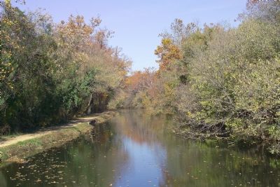
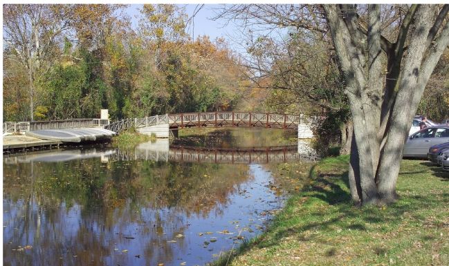
This view of the C&O canal from the marker. Footbridge leads from the Abner Cloud House parking lot on the right to the Fletcher's Boathouse parking lot on the left. Autos cross under the canal to Fletcher's Boathouse through a one lane road culvert beyond the footbridge.
Canal Road is one-way towards Georgetown weekdays in the morning rush hour and one-way from Georgetown in the evening. At all other times it is two-way, one lane in each direction at this point. And Reservoir Road is blocked to/from Canal Road during rush hours, so plan your trip carefully.
Related marker. Click here for another marker that is related to this marker. This marker has been replaced with the linked marker.
Credits. This page was last revised on December 25, 2023. It was originally submitted on December 1, 2006, by Tom Fuchs of Greenbelt, Maryland. This page has been viewed 6,193 times since then and 73 times this year. Last updated on December 2, 2006, by Tom Fuchs of Greenbelt, Maryland. Photos: 1. submitted on May 18, 2019, by A. Taylor of Laurel, Maryland. 2, 3. submitted on December 1, 2006, by Tom Fuchs of Greenbelt, Maryland. 4. submitted on December 2, 2006, by Tom Fuchs of Greenbelt, Maryland. 5, 6. submitted on October 15, 2016, by J. Makali Bruton of Accra, Ghana. • J. J. Prats was the editor who published this page.
