Pensacola in Escambia County, Florida — The American South (South Atlantic)
North Hill Preservation District
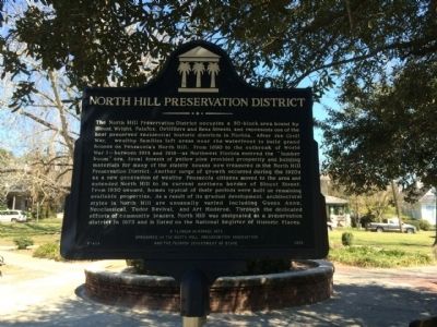
Photographed by Mark Hilton, March 10, 2014
1. North Hill Preservation District Marker
this page online
Erected 2001 by the North Hill Preservation Association & the Florida Department of State. (Marker Number F-454.)
Topics. This historical marker is listed in these topic lists: Notable Places • Settlements & Settlers. A significant historical year for this entry is 1890.
Location. 30° 25.369′ N, 87° 13.39′ W. Marker is in Pensacola, Florida, in Escambia County. It is on North Reus Street 0.1 miles north of De Soto Street, on the right when traveling north. Located in middle of Alabama Square Park. Touch for map. Marker is at or near this postal address: 1047 North Reus Street, Pensacola FL 32501, United States of America. Touch for directions.

Regionally, this marker is on the Florida Panhandle. It is also in the American South, specifically in the Deep South, and on the Gulf Coast. Globally, it is in the North Atlantic Region, North America, a Gulf of Mexico state, the Western Hemisphere, the Western World, and the Anglosphere. Historically, it finds itself in what was once New Spain, the territory of the Mississippian Culture, one of
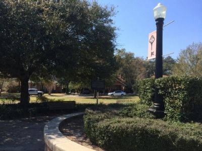
Photographed by Mark Hilton, March 10, 2014
2. Marker in Alabama Square
Other nearby markers. At least 8 other markers are within walking distance of this marker: A.M.E. Zion Cemetery (approx. 0.2 miles away); Magnolia Cemetery (approx. 0.2 miles away); Fort San Bernardo (approx. 0.2 miles away); General Francisco De Miranda (approx. 0.3 miles away); Original Site of Pensacola Junior College (approx. 0.4 miles away); Fort George (approx. 0.4 miles away); Pensacola Blues (approx. 0.4 miles away); a different marker also named Fort George (approx. half a mile away). Touch for a list and map of all markers in Pensacola.
Another marker is no longer nearby. Our Confederate Dead (was approx. 0.4 miles away but has been permanently removed).
Also see . . . North Hill website. (Submitted on March 12, 2014, by Mark Hilton of Montgomery, Alabama.)
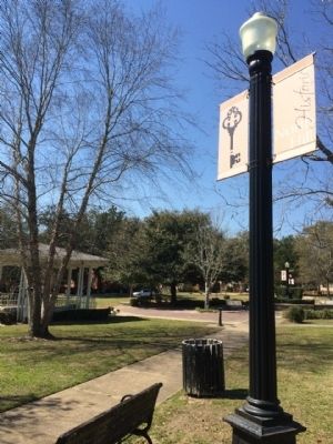
Photographed by Mark Hilton, March 10, 2014
3. Marker Area
Credits. This page was last revised on August 1, 2017. It was originally submitted on March 12, 2014, by Mark Hilton of Montgomery, Alabama. This page has been viewed 1,628 times since then and 88 times this year. Photos: 1, 2, 3. submitted on March 12, 2014, by Mark Hilton of Montgomery, Alabama. • Bernard Fisher was the editor who published this page.
