Comanche in Comanche County, Texas — The American South (West South Central)
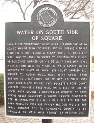
Water on South Side of Square
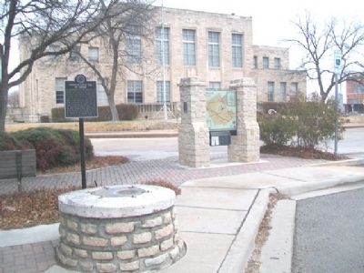
1859 first courthouse built near Fleming Oak at SW cor Sq was of slim log poles set on end (as a picket fence) with dirt floor & plank roof. The hand dug well was to furnish water to courthouse & public. As buildings burned on N side Sq in 1868 men made 2 lines from well on S side of Sq & passed water buckets to blaze. In July 1871 court ordered J. D. Wright to clean well, wall with stone from bottom to 2-1/2' above top of ground, cover with trap door, place pulley, two buckets & rope. Court ordered 12-14-1912 that well on S side of Sq be level with ground & covered. At removal of rock debris Oscar Callaway, a young lawyer suggested top be saved. 1912 S. L. Mull paid $25 for top for farm well. In 1996 his family Ms. Dois Mull & Bob Mull donated top to Comanche County to be replaced on well. Well rebuilt by Preston Cox.
Erected by Comanche County Historical Society.
Topics. This historical marker is listed in these topic lists: Man-Made Features • Settlements & Settlers. A significant historical month for this entry is July 1871.
Location. 31° 53.851′ N, 98° 36.281′ W. Marker is in Comanche, Texas, in Comanche County. Marker is at the intersection of Central Avenue (U.S. 67/377) and Houston Street, on the right when traveling west on Central Avenue . Marker is near the southwest corner of the county courthouse grounds. Touch for map. Marker is at or near this postal address: 101 West Central Avenue, Comanche TX 76442, United States of America. Touch for directions.
Other nearby markers. At least 8 other markers are within walking distance of this marker. Robert Thomas Hill (a few steps from this marker); General Ashbel Smith, C.S.A. (a few steps from this marker); Fleming Oak (a few steps from this marker); Indian Raid in Comanche (a few steps from this marker); Bicentennial Park (a few steps from this marker); Old Cora Courthouse (a few steps from this marker); Calaboose and rock with irons (a few steps from this marker); Veterans Memorial (a few steps from this marker). Touch for a list and map of all markers in Comanche.
Also see . . . City of Comanche, Texas. (Submitted on March 13, 2014, by William Fischer, Jr. of Scranton, Pennsylvania.)
Credits. This page was last revised on March 4, 2021. It was originally submitted on March 13, 2014, by William Fischer, Jr. of Scranton, Pennsylvania. This page has been viewed 533 times since then and 17 times this year. Photos: 1, 2. submitted on March 13, 2014, by William Fischer, Jr. of Scranton, Pennsylvania.

