Southwest Quadrant in Alexandria, Virginia — The American South (Mid-Atlantic)
The West End
Alexandria Heritage Trail
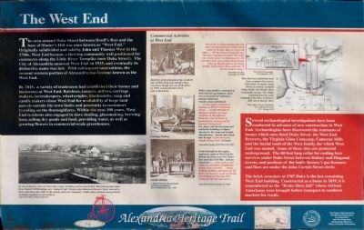
By 1815, a variety of tradesmen had established their homes and businesses at West End. Butchers, tanners, millers, carriage maker, tavernkeepers, wheelwrights, blacksmiths, soap and candle makers chose West End for availability of large land parcels outside the town limits and proximity to customers traveling on the thoroughfares. Within the next 100 years, West End residents also engaged in slave dealing, glassmaking, brewing beer, selling dry goods and food, providing water, as well as growing flowers in commercial-scale greenhouses.
"West End--a village joining this city and separated from the Corporation limits by Hooff's Run, is a very old place… We have heard old people say that they remembered when West End, was in one sense, 'a shipping port' for that they have seen a flat bottom boat come up Hooff's Run to the Stone Bridge, land oysters there, and take on board a return cargo " —Alexandria Gazette, September 28, 1868
While some families continued in West End for generations, there was a great deal of transiency among tradesmen. Charles Jones advertised: "... he has again commenced business at WEST END Duke Street....Coachmaking... having a number of steady workmen in different Branches, and all kinds of materials for carrying on his business Extensively." Yet Jones left next year and rented his buildings to James Sheehy for his Soap and Candle Manufactory. Sheehy advertised that he kept "a few thousand weight of hogs lard" on hand. —Alexandria Gazette 2/27/1798; 12/21/1811.
From throughout the region, employers came to West End for Hiring Out Day every New Year's Day until the Civil War. African American "...men, women and children, mechanics, fieldhands, dining room servants... eating, drinking, fiddling and dancing; all their own masters, so far as having the privilege of selecting their homes for the next year goes. —Alexandria Gazette, January 14, 1860.
(sidebar) Several archaeological investigations have been conducted in advance of new construction in West End. Archaeologists have discovered the remnants of homes which lined Duke Street, the West End Brewery, the Virginia Glass Company, Cameron Mills and the burial vault of the West family, for which West End was named. Some of these sites are protected underground. The 60-foot long cellar for cooling beer survives under Duke Street between Dulany and Diagonal streets, and portions of the bottle factory's gas furnaces and flues are under Carlyle Street circle.
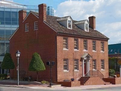
The brick structure at 1707 Duke is the last remaining West End building. Constructed as a home in 1819, it is remembered as the "Bruin Slave Jail" where African Americans were brought before transport to southern markets for resale.
Topics and series. This historical marker is listed in these topic lists: African Americans • Industry & Commerce • Settlements & Settlers. In addition, it is included in the Virginia, The City of Alexandria series list. A significant historical date for this entry is January 14, 1755.
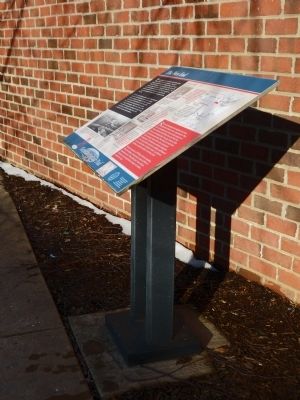
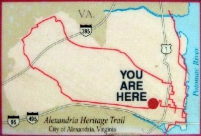
Location. 38° 48.192′ N, 77° 3.49′ W. Marker is in Alexandria, Virginia. It is in the Southwest Quadrant. Marker can be reached from the intersection of Jamieson Avenue and Daingerfield Road, on the right when traveling west. Marker is along the walkway beside Hooff's Run just west of the Marriott Residence Inn at 1456 Duke Street. Touch for map. Marker is in this post office area: Alexandria VA 22314, United States of America. Touch for directions.
Other nearby markers. At least 8 other markers are within walking distance of this marker. Hooff's Run Bridge (a few steps from this marker); The Duke Street Tanyard (within shouting
Photographed By Allen C. Browne, March 8, 2014
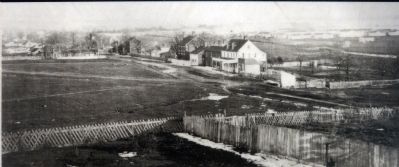
3. 1864 Photograph
In one view of the few views of West End, a large building can be seen in this 1864 photograph take from Shuter's Hill looking east. Samuel Catts' Tavern, also known as Drovers' Rest, catered to those who drove the cattle to nearby yards for slaughter. Cattle sales, elections and political meetings regularly occurred here.Close-up of photo on marker
National Archives
National Archives
Also see . . . Alexandria Heritage Trail. (Submitted on March 17, 2014.)
Photographed By Allen C. Browne, March 8, 2014
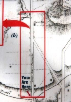
5. Plan of the Town of Alexandria, D.C. with the environs -- M.C. Ewing, 1845
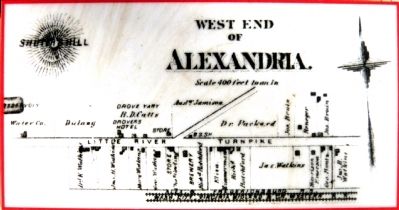
West End was established near three commercial arteries: Little River Turn Pike (Duke Street), Leesburg Turnpike (King Street) and Hooff's Run, a navigable stream. The village extended from the water company at the base of Shuter's Hill east of Hooff's Run. Close-up of map on marker
Photographed By Allen C. Browne, March 15, 2014
7. 1707 Duke Street -- Bruin's Slave Jail
1707, the last remnant of the old West End, was Bruin's Slave Jail before the Civil War. The Edmonson sisters were held here after the failure of the Pearl escape in 1848. During the Civil War, this building was the courthouse of the restored (Loyal-Unionist) government of Fairfax County.
Credits. This page was last revised on January 27, 2023. It was originally submitted on March 17, 2014, by Allen C. Browne of Silver Spring, Maryland. This page has been viewed 1,368 times since then and 44 times this year. Photos: 1, 2, 3, 4, 5, 6, 7. submitted on March 17, 2014, by Allen C. Browne of Silver Spring, Maryland. • Bernard Fisher was the editor who published this page.
