Downtown in Anchorage, Alaska — Northwest (North America)
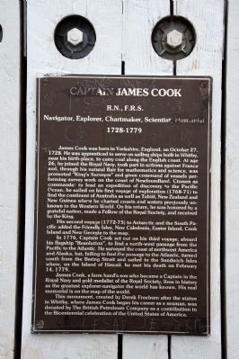
Captain James Cook
R.N., F.R.S.
| — | Navigator, Explorer, Chartmaker, Scientist, Humanist / 1728 – 1779 | — |
Photographed by Byron Hooks, September 1, 2013
1. James Cook Marker
His second voyage (1772–75) to Antarctica and the South Pacific added the Friendly Isles, New Caledonia, Easter Island, Cook Island and New Georgia to the map.
In 1776, Captain Cook set out on his third voyage, aboard his flagship “Resolution”, to find a north-west passage from the Pacific to the Atlantic. He surveyed the coast of Northwest America and Alaska, but, failing to find the passage to the Atlantic, turned south from the Bering Sea and sailed to the Sandwich Isles where, on the island of Hawaii, he met his death on February 14, 1779.
James Cook, a farm hand’s son who became a Captain in the Royal Navy and gold medalist of the Royal Society, lives in history is the greatest explorer–navigator the world has known. His real memorial is on the map of the world.
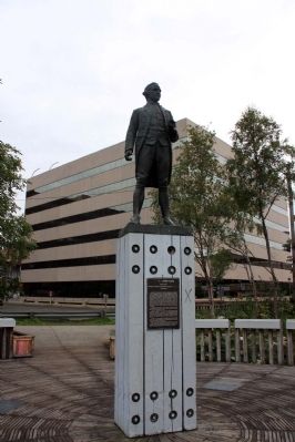
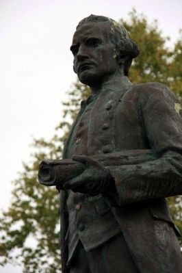
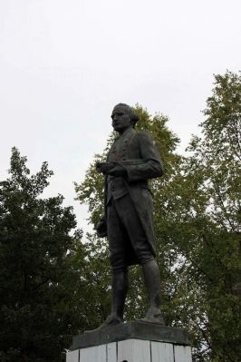
This monument, created by Derek Freeborn after the statue in Whitby, were James Cook began his career as a seaman, was donated by the British Petroleum Company as a contribution
this page online
Erected 1976 by British Petroleum Company.
Topics. This historical marker is listed in these topic lists: Exploration • Waterways & Vessels. A significant historical month for this entry is February 1792.
Location. 61° 13.159′ N, 149° 54.238′ W. Marker is in Anchorage, Alaska. It is in Downtown. It can be reached from L Street. This marker is attached to the base of a statue of James Cook. The statue and marker are located in Resolution Park. Touch for map. Marker is at or near this postal address: 300 L St, Anchorage AK 99501, United States of America. Touch for directions.

Regionally, this marker is in the Alaska Railroad Corridor, in the Athabascan Region, in the Prince William Sound, and in Southcentral Alaska. It is also on the American Pacific Coast. Globally, it is in North America, on the Ring of Fire, on the Pacific Rim, in the Western Hemisphere, in the Western World, and in the Anglosphere. Historically, it finds itself in what was once the Russian Empire.
Other nearby markers. At least 8 other markers are within walking distance of this marker:
Photographed by Byron Hooks, September 1, 2013
2. James Cook Marker
Related marker. Click here for another marker that is related to this marker. To better understand the relationship, study each marker in the order shown.
Also see . . .
1. James Cook. Wikipedia (Submitted on September 14, 2013, by Byron Hooks of Sandy Springs, Georgia.)
2. Captain Cook Time-line. Captain Cook Country (Submitted on September 14, 2013, by Byron Hooks of Sandy Springs, Georgia.)
3. Cook Inlet. Wikipedia (Submitted on September 14, 2013, by Byron Hooks of Sandy Springs, Georgia.)
Photographed by Byron Hooks, September 1, 2013
3. Captain James Cook
Photographed by Byron Hooks, September 1, 2013
4. Captain James Cook
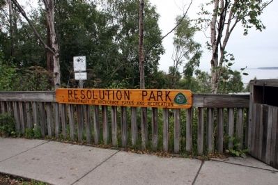
Photographed by Byron Hooks, September 1, 2013
5. Entrance to Resolution Park
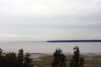
Photographed by Byron Hooks, September 1, 2013
6. Cook Islet
Credits. This page was last revised on June 16, 2016. It was originally submitted on September 14, 2013, by Byron Hooks of Sandy Springs, Georgia. This page has been viewed 1,520 times since then and 50 times this year. Last updated on March 21, 2014, by Richard E. Miller of Oxon Hill, Maryland. Photos: 1, 2, 3, 4, 5, 6. submitted on September 14, 2013, by Byron Hooks of Sandy Springs, Georgia. • Bill Pfingsten was the editor who published this page.
