Mission Dolores in San Francisco City and County, California — The American West (Pacific Coastal)
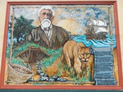
The Coast Miwok
We lived in harmony with the planet for thousands of years. We respected the earth and we were thankful for all the gifts it gave us.
With the invasion of outsiders our lives were shattered. We were imprisoned, forced into slave labor and punished for following our beliefs.
The California Rancheria Act of 1958 was the final blow in a long series of government actions designed to kill us off and gain control of our land. Over the next 40 years, we found the strength to organize and fight those who had tried to erase us from our native land.
Through hard work and perseverance our rights were finally restored on December 27, 2000.
We have a long way to go but today, there is more hope for survival & prosperity than anytime in the last 250 yrs.
Topics. This historical marker is listed in this topic list: Native Americans. A significant historical month for this entry is December 1882.
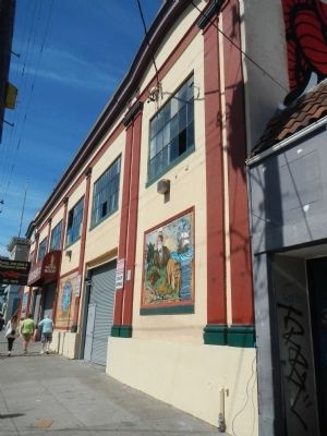
Location. 37° 45.905′ N, 122° 25.375′ W. Marker is in San Francisco, California, in San Francisco City and County. It is in Mission Dolores. Marker is on 16th Street near Albion Street, on the right when traveling north. Touch for map. Marker is at or near this postal address: 3140 16th Street, San Francisco CA 94103, United States of America. Touch for directions.
Other nearby markers. At least 8 other markers are within walking distance of this marker. Site of Original Mission Dolores Chapel and Dolores Lagoon / Rammaytush (about 400 feet away, measured in a direct line); Elixir (about 400 feet away); The Frank J. Portman Memorial Diorama (approx. 0.2 miles away); El Camino Real (approx. 0.2 miles away); Misión San Francisco de Asís (approx. 0.2 miles away); Louis Roesch Building (approx. 0.2 miles away); Fray Francisco Palou, O.F.M. (approx. ¼ mile away); La Misión San Francisco de Asís (approx. ¼ mile away). Touch for a list and map of all markers in San Francisco.
Also see . . . Ohlone and Coast Miwok Peoples. San Francisco State University website entry:
Archeological evidence indicates that the Miwok people chose to inhabit areas near small bays, lagoons and streams. The Peninsula had an abundance of food and the Miwok's daily activities included large game and bird hunting, fishing, and acorn gathering and processing. (Submitted on March 22, 2014, by Barry Swackhamer of Brentwood, California.)
Credits. This page was last revised on February 7, 2023. It was originally submitted on March 22, 2014, by Barry Swackhamer of Brentwood, California. This page has been viewed 431 times since then and 14 times this year. Photos: 1, 2. submitted on March 22, 2014, by Barry Swackhamer of Brentwood, California. • Bill Pfingsten was the editor who published this page.

