Embarcadero in San Francisco City and County, California — The American West (Pacific Coastal)
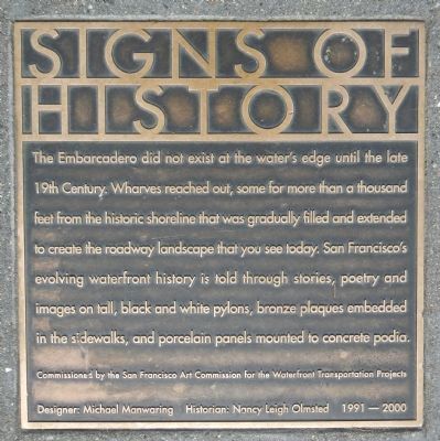
Signs of History
The Embarcadero
Photographed by Barry Swackhamer, March 20, 2014
1. Signs of History Marker
Commissioned by the San Francisco Art Commission for the Waterfront Transportation Projects
Designer: Michael Manwaring, Historian: Nancy Leigh Olmsted 1991-2000
Erected by San Francisco Art Commission for the Waterfront Transportation Projects.
Topics. This historical marker is listed in this topic list: Notable Places.
Location. 37° 47.714′ N, 122° 23.62′ W. Marker is in San Francisco, California, in San Francisco City and County. It is in Embarcadero. It is on Embarcadero near Market Street, on the left when traveling east. Touch for map. Marker is at or near this postal address: 5 The Embarcadero,
this page online

Regionally, this marker is on California’s Coast Ranges. It is also on the American Pacific Coast. Globally, it is in North America, on the Ring of Fire, in the Pacific Rim, in the Western Hemisphere, in the Western World, and in the Anglosphere. Historically, it finds itself in what was once New Spain and also Mexico’s Alta California.
Other nearby markers. At least 8 other markers are within walking distance of this marker: Port Time (here, next to this marker); Ferry Building (a few steps from this marker); Klebingat Recalls The City Front (within shouting distance of this marker); Fruit Seller (within shouting distance of this marker); Freeway Supports (within shouting distance of this marker); San Francisco Vietnam Veterans Memorial (about 300 feet away, measured in a direct line); Stephan C. Leonoudakis (about 300 feet away); a different marker also named Splendid Survivor (about 400 feet away). Touch for a list and map of all markers in San Francisco.
Other markers no longer nearby. Splendid Survivor (was a few steps from this marker
Photographed by Barry Swackhamer, March 20, 2014
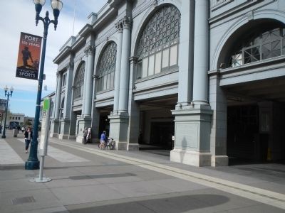
2. Signs of History Marker
The marker is on the left, in front of the light pole.
More about this marker. This marker is embedded in the sidewalk in front of the Ferry Building.
Also see . . . Embarcadero (San Francisco) - Wikipedia. The Embarcadero right-of-way begins at the intersection of Second and King Streets near AT&T Park, and travels north, passing under the San Francisco – Oakland Bay Bridge. The sidewalk along the waterfront between Harrison Street and Broadway was named "Herb Caen Way..." after the death of celebrated local columnist Herb Caen in 1997. (Submitted on March 26, 2014, by Barry Swackhamer of Brentwood, California.)
Photographed by Barry Swackhamer, March 20, 2014
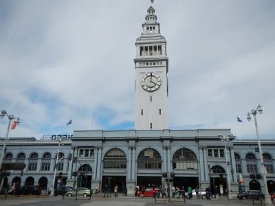
3. San Francisco Ferry Building
Photographed by Barry Swackhamer, March 20, 2014
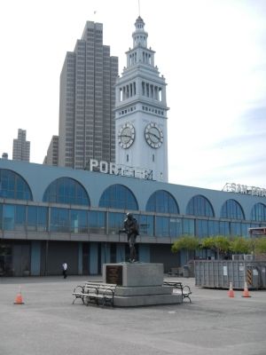
4. San Francisco Ferry Building
Statue of Mohandas Gandhi in the foreground.
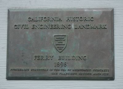
Photographed by Barry Swackhamer, March 20, 2014
5. San Francisco Ferry Building, an engineering landmark
Credits. This page was last revised on February 7, 2023. It was originally submitted on March 26, 2014, by Barry Swackhamer of Brentwood, California. This page has been viewed 1,119 times since then and 57 times this year. Photos: 1, 2, 3, 4, 5. submitted on March 26, 2014, by Barry Swackhamer of Brentwood, California. • Bill Pfingsten was the editor who published this page.
