Downtown Oakland in Alameda County, California — The American West (Pacific Coastal)
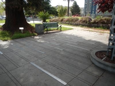
Lafayette Square Timeline
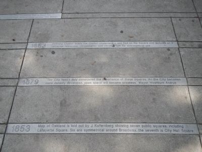
1853 - Map of Oakland is laid out by J. Kellersberg showing seven public squares, including Lafayette Square. Six are symmetrical around Broadway, the seventh is City Hall Square.
1879 – “The City hasn’t duly considered the importance of these squares. As the City becomes more densely developed, open space will become priceless” – Mayor Washburn Andrus.
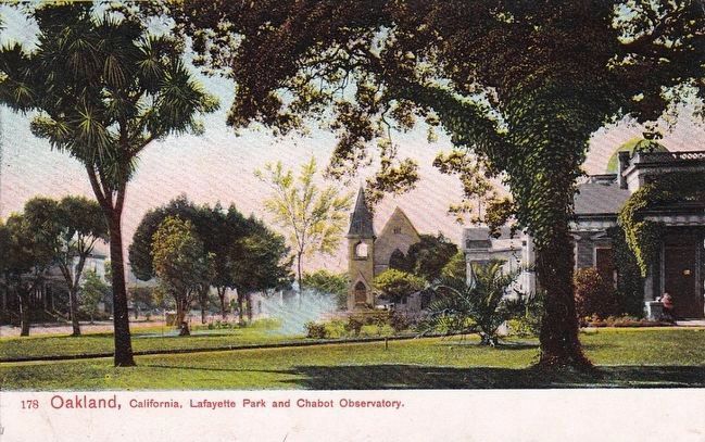
1883 - Anthony Chabot builds the Chabot Observatory and Hall of Science and includes an 8” refractor telescope, chronometer and chronograph for astronomical use.
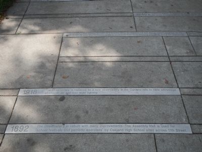
1892 – The Observatory is rebuilt with many improvements. The Assembly Hall is used for ‘school festivals and patriotic exercises’ by Oakland High School sited across 11th Street.
1918 – The Observatory is replaced by a new observatory in the Oakland Hills to take advantage of cleaner air and less night lighting.
1929 – The original Observatory buildings are torn down. A time capsule dating from 1881 is discovered in its cornerstone.
1930’s – The Square is used as a meeting place for unemployed men and so-called agitators to the point that a debate permit is revolted in 1934. Soup kitchens are set up during the Depression.
1940’s – “Petticoat Corner” is established at the Square for the exclusive use of the “weaker sex” so the female population will not be subjected to the “sit and argue boys.”
1951 – “Alfresco checkers and card games are favorite pastimes in Lafayette Square” – Jack Burroughs, Oakland Tribune.
1958 – Lafayette Square is renovated with a new canopy restroom, horseshoe pit and game tables with funds raised by the Lakeview Junior Women’s Club.
1960’s and 1970’s – The Square gradually become known as “Old Man’s Park” and continues to be used by the public for leisure and political activities.
1980’s – Due to a decline in social programs and economic conditions, there is a increase in transient and homeless populations in the Square.
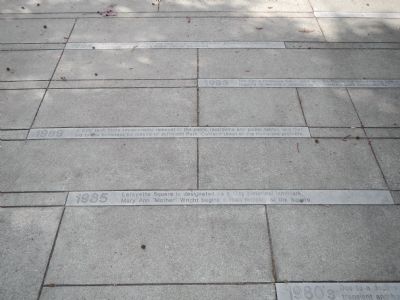
1985 – Lafayette Square is designated as a City historical landmark. Mary Ann “Mother” Wright begins a food ministry at the Square.
1989 – A City task force recommends removal of the public restroom and picnic tables and that aid to the homeless be moved to Jefferson Park. Oakland Union of the Homeless protests.
1993 – The City’s Homeless Commission and the Center for Urban Family Life meet with park regulars to develop a strategy for Lafayette Square improvements.
1994 – The LEF Foundation funds two local design firms to conduct broad-based community workshops and develop a master plan for the Square.
1995 – The City adopts the Lafayette Square – Old Man’s Park Master Plan.
1996 – The City receives a National Park Service Urban Parks and Recreation Recovery Program, (UPARR) grant to construct new restrooms in the Square.
1997 – Measure I, a municipal bond for park improvements passed by the voters of Oakland funds Phase 1 improvements.
1998 – The Healthy City Oakland Fund is contracted by the City to oversee the renovation of Lafayette Square Park.
1999 – Phase 1 Master Plan improvements are completed, including the restrooms, play area, horseshoe pits and the grass hillock. An all-day celebration is held.
2000 – The Square receives an Environmental Design Research Association/PLACES Design Award for excellence in the design of public spaces.
2001 – Phase II of Master Plan is completed. Proposition 12, a state bond, provides funding for the completion of the Master Plan.
Topics. This historical marker is listed in this topic list: Charity & Public Work. A significant historical year for this entry is 1853.
Location. 37° 48.229′ N, 122° 16.605′ W. Marker is in Oakland, California, in Alameda County. It is in Downtown Oakland. Marker is on 11th Street, on the left when traveling west. Touch for map. Marker is at or near this postal address: 625 11th Street, Oakland CA 94607, United States of America. Touch for directions.
Other nearby markers. At least 8 other markers are within walking distance of this marker. Chabot Observatory (within shouting distance of this marker); The Pardee House (about 400 feet away, measured in a direct line); Preservation Park (about 600 feet away); Charles S. Greene Library (approx. 0.2 miles away); First Unitarian Church of Oakland (approx. 0.2 miles away); Jefferson Square Park (approx. 0.2 miles away); Oakland City Hall (approx. ¼ mile away); 1946 General Strike (approx. 0.3 miles away). Touch for a list and map of all markers in Oakland.
Additional keywords. public parks
Credits. This page was last revised on February 7, 2023. It was originally submitted on April 2, 2014, by Barry Swackhamer of Brentwood, California. This page has been viewed 732 times since then and 66 times this year. Photos: 1, 2, 3, 4. submitted on April 2, 2014, by Barry Swackhamer of Brentwood, California. 5. submitted on November 1, 2015. • Bill Pfingsten was the editor who published this page.
