Near Arcadia in DeSoto County, Florida — The American South (South Atlantic)
Owens Community School
Photographed by PaulwC3, March 14, 2014
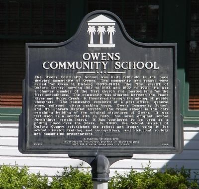
1. Owens Community School Marker
Inscription.
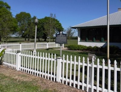
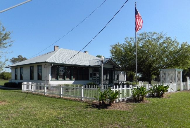
Owens Community School. . The Owens Community School was built 1916-1918 in the once thriving community of Owens. The community and school were named for Owen H. Dishong (1850-1902), the first sheriff of DeSoto County, serving 1887 to 1893 and 1897 to 1901. He was a charter member of the first church and donated land for the first schoolhouse. The community was situated between the Peace River and Horse Creek. It flourished through the mining of pebble phosphate. The community consisted of a post office, general store, railroad, citrus packing house, Owens Community School, and Mt. Ephraim Baptist Church. The frame school is the only remaining building of the original structures of Owens. It was last used as a school site in 1946, but some original school furnishings remain intact. It has continued to be used as a polling place over the years. In 2000, the School District of DeSoto County refurbished the school and began using it for school district training and recognitions, and historical society and humanities presentations.
The Owens Community School was built 1916-1918 in the once thriving community of Owens. The community and school were named for Owen H. Dishong (1850-1902), the first sheriff of DeSoto County, serving 1887 to 1893 and 1897 to 1901. He was a charter member of the first church and donated land for the first schoolhouse. The community was situated between the Peace River and Horse Creek. It flourished through the mining of pebble phosphate. The community consisted of a post office, general store, railroad, citrus packing house, Owens Community School, and Mt. Ephraim Baptist Church. The frame school is the only remaining building of the original structures of Owens. It was last used as a school site in 1946, but some original school furnishings remain intact. It has continued to be used as a polling place over the years. In 2000, the School District of DeSoto County refurbished the school and began using it for school district training and recognitions, and historical society and humanities presentations.
Erected 2004 by School District of DeSoto County and the Florida Department of State. (Marker Number F-525.)
Topics.
Click or scan to see this page online
This historical marker is listed in these topic lists: Education • Settlements & Settlers. A significant historical year for this entry is 1887.
Location. 27° 10.819′ N, 81° 56.031′ W. Marker is near Arcadia, Florida, in DeSoto County. It is at the intersection of SW Owens School Road and Thigpen Avenue, on the right when traveling west on SW Owens School Road. Touch for map. Marker is at or near this postal address: 5586 SW Owens School Road, Arcadia FL 34266, United States of America. Touch for directions.
Regionally, this marker is in the American South. Globally, it is in the North Atlantic Region, North America, a Gulf of Mexico state, the Western Hemisphere, the Western World, and the Anglosphere. Historically, it finds itself in what was once New Spain, the territory of the Mississippian Culture, one of the Confederate States of America, and the Antebellum South.
Credits. This page was last revised on June 16, 2016. It was originally submitted on April 6, 2014, by PaulwC3 of Northern, Virginia. This page has been viewed 1,311 times since then and 37 times this year. Photos:1, 2, 3. submitted on April 6, 2014, by PaulwC3 of Northern, Virginia.