Danbury in Fairfield County, Connecticut — The American Northeast (New England)
Danbury Disasters
Danbury, Connecticut
— The Museum in the Streets® —
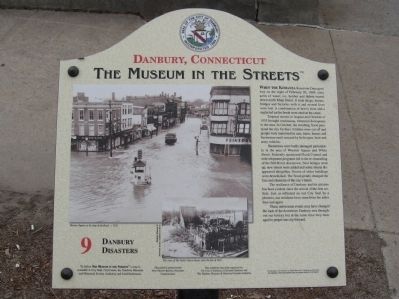
When the Kohanza Reservoir Dam gave way on the night of February 20, 1869, sixty acres of water, ice, lumber and debris roared down north Main Street. It took shops, homes, bridges and factories with it and several lives were lost. A combination of heavy frost and a neglected earlier break were cited as the cause.
Tropical storms in August and October of 1955 brought continuous, torrential downpours to the area. In October, the resulting flood paralyzed the city for days. Utilities were cut off and people were marooned in cars, trains, homes and businesses until rescued by helicopter, boat and army vehicles.
Businesses were badly damaged particularly in the area of Wooster Square and White Street. Federally sponsored Flood Control and redevelopment programs led to the re-channeling of the Still River downtown. New bridges went up, new streets were added and some streets disappeared altogether. Scores of older buildings were demolished. The flood greatly changed the face and character of the city’s future.
The resilience of Danbury and its citizens has been evident since the arrival of the first settlers. Just as reflected on our City Seal by a phoenix, our residents have risen from the ashes time and again.
These unforeseen events may have changed the look of the downtown Danbury area throughout our history but at the same time they managed to propel our city forward.
Erected by The Museum in the Streets®. (Marker Number 9.)
Topics and series. This historical marker is listed in this topic list: Disasters. In addition, it is included in the The Museum in the Streets®: Danbury, Connecticut series list. A significant historical date for this entry is February 20, 1869.
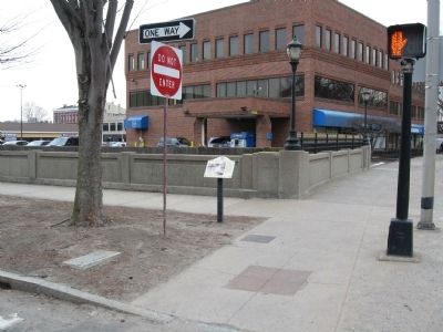
Location. 41° 23.814′ N, 73° 27.282′ W. Marker is in Danbury, Connecticut, in Fairfield County. Marker is on Crosby Street near Main Street, on the left when traveling west. Touch for map. Marker is in this post office area: Danbury CT 06810, United States of America. Touch for directions.
Other nearby markers. At least 8 other markers are within walking distance of this marker. Wooster Square (within shouting distance of this marker); Higher Education (about 300 feet away, measured in a direct line); The News Around Town (about 300 feet away); Trains, Trolleys & Transportation (about 500 feet away); Danbury Fair Days (about 600 feet away); The Danbury Fire Department (about 600 feet away); Charles Edward Ives – The Father of Modern Music (about 700 feet away); Marian Anderson (about 700 feet away). Touch for a list and map of all markers in Danbury.
Credits. This page was last revised on November 25, 2021. It was originally submitted on April 6, 2014, by Michael Herrick of Southbury, Connecticut. This page has been viewed 664 times since then and 20 times this year. Photos: 1, 2. submitted on April 6, 2014, by Michael Herrick of Southbury, Connecticut.

