
White Pass & Yukon Route
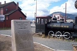
Golden Spike Centennial

One hundred years later – on July 29, 2000 a new ceremonial spike was driven to honor the courage and dedication that built the first northern railway and to pledge a commitment to a second century of service.
Erected 2000 by Carcross, Yukon Territory, July 29.
Topics. This historical marker is listed in these topic lists: Railroads & Streetcars • Waterways & Vessels. A significant historical date for this entry is July 29, 1900.
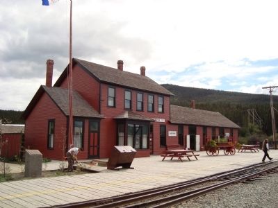
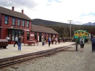
Location. 60° 9.913′ N, 134° 42.208′ W. Marker is in Carcross, Yukon, in Unorganized Yukon. It is on Tagish Avenue. This marker is in a park near the WP&YR Depot. Touch for map. Marker is at or near this postal address: 26 Caribou Rd, Carcross YT Y0B 1B0, Canada. Touch for directions.
Regionally, this marker is in the Canadian North. Globally, it is in North America, on the Ring of Fire,
this page online
Other nearby markers. At least 8 other markers are within walking distance of this marker: A different marker also named White Pass & Yukon Route (a few steps from this marker); SS Tutshi Mechanical Equipment (within shouting distance of this marker); "The Crew of the "SS Tutshi" (within shouting distance of this marker); "Tutshi" Mechanics (within shouting distance of this marker); Freighting on the Southern Lakes (within shouting distance of this marker); Adapting to Changing Times (within shouting distance of this marker); Boats of the Southern Lakes (within shouting distance of this marker); WP & YR and Carcross (within shouting distance of this marker). Touch for a list and map of all markers in Carcross.
Regarding White Pass & Yukon Route. Carcross — The Tagish people call this area Todezzane, “blowing all the time”and the Tlingit called call it Naataase Heen, “water running through the narrows”. In 1899, the community was officially named Caribou Crossing,
J.H. Brownlee surveyed the town site in 1899 for the White Pass & Yukon Route (WP&YR)... The town was established by WP&YR to maintain the rail line and connect freight and passengers to Atlin and points around the lake via the sternwheelers.
--Taken from Carcross Historic Buildings Walking Tour.
Also see . . .
1. Carcross, Yukon Territory - Wikipedia. (Submitted on November 10, 2011, by Barry Swackhamer of Brentwood, California.)
2. White Pass & Yukon Route – Wikipedia Entry. “The line was born of the Klondike Gold Rush of 1897. The most popular route taken by prospectors to the gold fields in Dawson City was a treacherous route from the port in Skagway or Dyea, Alaska, across the mountains to the Canadian border at the summit of the Chilkoot Pass or the White Pass. There, the prospectors were not allowed across by Canadian authorities unless they had one ton of supplies. This usually required several trips
Credits. This page was last revised on June 16, 2016. It was originally submitted on November 10, 2011, by Barry Swackhamer of Brentwood, California. This page has been viewed 1,315 times since then and 36 times this year. Last updated on April 8, 2014, by Richard E. Miller of Oxon Hill, Maryland. Photos: 1, 2. submitted on November 10, 2011, by Barry Swackhamer of Brentwood, California. 3. submitted on July 16, 2015, by Rev. Ronald Irick of West Liberty, Ohio. 4, 5, 6. submitted on November 10, 2011, by Barry Swackhamer of Brentwood, California. • Bill Pfingsten was the editor who published this page.
