Near Ashton in Fremont County, Idaho — The American West (Mountains)
Caldera Lookout
Photographed by Cosmos Mariner, June 19, 2013
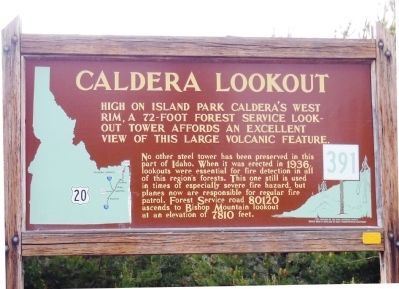
1. Caldera Lookout Marker
High on Island Park Caldera's west rim, a 72-foot forest service lookout tower affords an excellent view of this large volcanic feature.
No other steel tower has been preserved in this part of Idaho. When it was erected in 1936, lookouts were essential for fire detection in all of this region's forests. This one is still used in times of especially severe fire hazard, but planes now are responsible for regular fire patrol. Forest Service road 80120 ascends to Bishop Mountain lookout at an elevation of 7810 feet.
Erected by Idaho Historical Society. (Marker Number 391.)
Topics and series. This historical marker is listed in these topic lists: Architecture • Charity & Public Work • Horticulture & Forestry. In addition, it is included in the Idaho State Historical Society series list. A significant historical year for this entry is 1936.
Location. 44° 17.068′ N, 111° 27.792′ W. Marker is near Ashton, Idaho, in Fremont County. It is on U.S. 20 0.1 miles south of North Antelope Flat Road, on the left when traveling north. Marker is located in a roadside pull-out on the west side of US Highway 20, just south
this page online

Regionally, this marker is in Eastern Idaho and the Yellowstone Fringe. It is also in the American Mountain West. Globally, it is in North America, the Rocky Mountains, the Western Hemisphere, the Western World, and the Anglosphere.
Other nearby markers. At least 8 other markers are within 14 miles of this marker, measured as the crow flies: Harriman State Park (approx. 1.7 miles away); Harriman Wildlife Refuge (approx. 5½ miles away); Volcanic Calderas (approx. 7.1 miles away); Big Falls Inn (approx. 9½ miles away); Bear Gulch Ski Basin (approx. 12½ miles away); The Three Tetons (approx. 12.6 miles away); Island Park (approx. 12.7 miles away); Teton Mountain Range (approx. 13.2 miles away). Touch for a list and map of all markers in Ashton.
Also see . . . Driving Guide to Historic Sites: Island Park, Idaho. Fremont County Website entry:
Driving north from Ashton, Idaho's Visitor's Center on U. S. Hwy. 20, you soon begin climbing what is locally known as the "Ashton Hill," and enter the Caribou-Targhee National Forest. After topping the hill, you reach a turnout marked by a road sign labeled "Caldera Lookout." It reveals some interesting information about the caldera's formation. This sign is located at the turnoff to reach a historical site on Bishop Mountain on North Antelope Flats Road. Bishop Mountain also forms a portion of the west rim of the volcano 12.6 miles from the highway.
Atop
Photographed by Cosmos Mariner, June 19, 2013
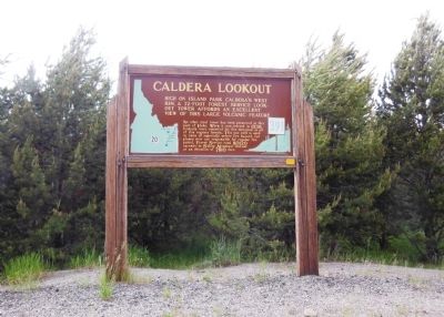
2. Caldera Lookout Marker (wide view)
Credits. This page was last revised on May 13, 2023. It was originally submitted on April 12, 2014, by Cosmos Mariner of Cape Canaveral, Florida. This page has been viewed 5,755 times since then and 299 times this year. Photos: 1. submitted on April 12, 2014, by Cosmos Mariner of Cape Canaveral, Florida. 2. submitted on April 13, 2014, by Cosmos Mariner of Cape Canaveral, Florida. • Syd Whittle was the editor who published this page.
