McKean in Erie County, Pennsylvania — The American Northeast (Mid-Atlantic)
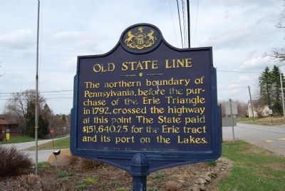
Old State Line
Erected 1946 by Pennsylvania Historical and Museum Commission.
Topics and series. This historical marker is listed in this topic list: Notable Places. In addition, it is included in the Pennsylvania Historical and Museum Commission series list. A significant historical year for this entry is 1792.
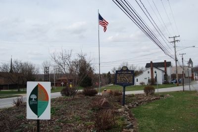
Location. 41° 59.969′ N, 80° 8.527′ W. Marker is in McKean, Pennsylvania, in Erie County. Marker is at the intersection of North Main Street and Edinboro Road (Pennsylvania Route 99), on the right when traveling north on North Main Street. Touch for map. Marker is in this post office area: Mc Kean PA 16426, United States of America. Touch for directions.
Other nearby markers. At least 8 other markers are within 8 miles of this marker, measured as the crow flies. Erie (approx. 4.6 miles away); Erie Extension Canal (approx. 5.4 miles away); a different marker also named Old State Line (approx. 5.7 miles away); Presque Isle Portage (approx. 6.6 miles away); The Bell Tower and Carillon (approx. 7.3 miles away); a different marker also named Erie (approx. 7.4 miles away); Michael Cannavino (approx. 7˝ miles away); Giant Gondola Wheel (approx. 7.6 miles away).
Credits. This page was last revised on June 16, 2016. It was originally submitted on April 13, 2014, by Mike Wintermantel of Pittsburgh, Pennsylvania. This page has been viewed 445 times since then and 25 times this year. Photos: 1, 2. submitted on April 13, 2014, by Mike Wintermantel of Pittsburgh, Pennsylvania.

