Middleport in Niagara County, New York — The American Northeast (Mid-Atlantic)
Early Church
Universalist Church
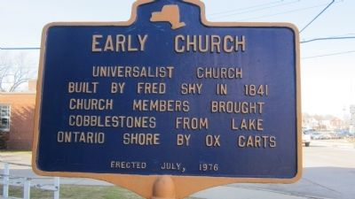
Photographed by Anton Schwarzmueller, April 6, 2014
1. Early Church Marker
Erected 1976.
Topics and series. This historical marker is listed in this topic list: Religion & Religious Structures. In addition, it is included in the Unitarian Universalism (UUism) series list. A significant historical year for this entry is 1841.
Location. 43° 12.655′ N, 78° 28.589′ W. Marker is in Middleport, New York, in Niagara County. It is at the intersection of Main Street (New York State Route 271) and Church Street, on the left when traveling north on Main Street. Touch for map. Marker is at or near this postal address: 44 Main Street, Middleport NY 14105, United States of America. Touch for directions.

Regionally, this marker is in Upstate New York, specifically in Western New York, and in the Buffalo Metropolitan Area. It is also in the American Northeast and in the Mid-Atlantic. Globally, it is in North America, on the Great Lakes, in the Western Hemisphere, in the Western World, and in the Anglosphere. Historically, it finds itself in what was once the Viceroyalty of New
this page online
Other nearby markers. At least 8 other markers are within walking distance of this marker: Clute-Phillips Post 938 Veterans Memorial (within shouting distance of this marker); Veterans Memorial (within shouting distance of this marker); Middleport Veterans Memorial (within shouting distance of this marker); a different marker also named Veterans Memorial (within shouting distance of this marker); McClintock Loomis Clock (about 400 feet away, measured in a direct line); Canal Tow Path (about 800 feet away); Taylor House (approx. 0.3 miles away); Early Home (approx. 0.4 miles away). Touch for a list and map of all markers in Middleport.
Also see . . . Cobblestone Masonry - The Cobblestone Museum. (Submitted on April 15, 2014, by Anton Schwarzmueller of Wilson, New York.)
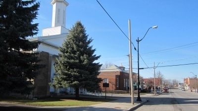
Photographed by Anton Schwarzmueller, April 6, 2014
2. Northward View Early Church Marker
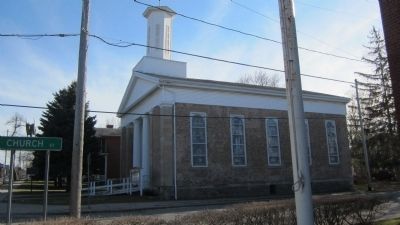
Photographed by Anton Schwarzmueller, April 6, 2014
3. Southward View Early Church Marker
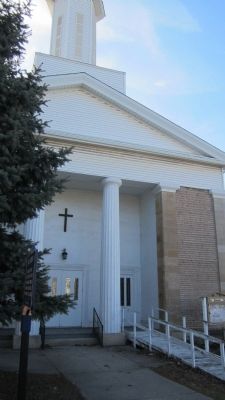
Photographed by Anton Schwarzmueller, April 6, 2014
4. Westward View Early Church Marker
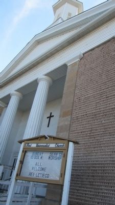
Photographed by Anton Schwarzmueller, April 6, 2014
5. Upward View Early Church
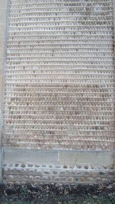
Photographed by Anton Schwarzmueller, April 6, 2014
6. Cobblestone Panel of Early Church
Front side, south panel, atop cut limestone watertable.
Credits. This page was last revised on June 16, 2016. It was originally submitted on April 15, 2014, by Anton Schwarzmueller of Wilson, New York. This page has been viewed 554 times since then and 51 times this year. Photos: 1, 2, 3, 4, 5, 6. submitted on April 15, 2014, by Anton Schwarzmueller of Wilson, New York. • Bill Pfingsten was the editor who published this page.
