Colmar Manor in Prince George's County, Maryland — The American Northeast (Mid-Atlantic)
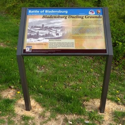
Bladensburg Dueling Grounds
Battle of Bladensburg
— Star Spangled Banner National Historic Trail —
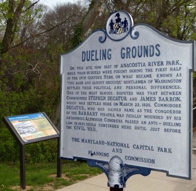
More than 26 recorded and 50 reported duels were fought in the 1800's — including the duel between Commodore Stephen Decatur and Commodore James Barron in 1820. Decatur and Barron were both captains in the Navy. Decatur was on a court-martial board that found Barron guilty of neglect of duty. They met to duel with pistols at eight paces. Decatur was killed and Barron wounded.
Duels were officially banned in 1839 in Maryland, but likely continued here until the Civil War when this site was used as a camp adjacent to Fort Lincoln.
Barney's Position
During the battle, Commodore Joshua Barney took a position on the hills above the dueling grounds — providing the tactical advantage. He held his cannons until the British were within a few hundred yards and fired the massive eighteen-pounder, clearing the road several times. The British retreated to the safety of the natural ravine.
Erected 2014 by National Park Service .
Topics and series. This historical marker is listed in this topic list: War of 1812. In addition, it is included in the Star Spangled Banner National Historic Trail series list. A significant historical year for this entry is 1808.
Location. 38° 56.044′ N, 76° 57.147′ W. Marker is in Colmar Manor, Maryland, in Prince George's County. Marker is at the intersection of Bladensburg Road (U.S. 1) and 38th Avenue, on the left when traveling south on Bladensburg Road. At the north of the small bridge over dueling creek at the Bladensburg dueling grounds. This was Tourncliff's bridge during the battle in 1814. Touch for map. Marker is in this post office area: Brentwood MD 20722, United States of America. Touch for directions.
Other nearby markers. At least 8 other markers are within walking distance of this marker. The Road to the Capital (here, next to this marker); Dueling Grounds (here, next to this marker); a different marker also named Dueling Grounds (about 300 feet away, measured in a direct line); Marines & Flotillamen (about 400 feet away); A Valiant Stand (about 400 feet away); The Road to the Capitol (about 400 feet away); Second Line Falls (approx. 0.2 miles away); a different marker also named The Road to the Capital (approx. 0.2 miles away). Touch for a list and map of all markers in Colmar Manor.
More about this marker. This marker replaces the "Second Line Falls" marker (HMdb #61136) at this location.
Credits. This page was last revised on June 16, 2016. It was originally submitted on April 22, 2014, by Allen C. Browne of Silver Spring, Maryland. This page has been viewed 979 times since then and 87 times this year. Photos: 1, 2, 3. submitted on April 22, 2014, by Allen C. Browne of Silver Spring, Maryland. • Bill Pfingsten was the editor who published this page.


