Abiquiu in Rio Arriba County, New Mexico — The American Mountains (Southwest)
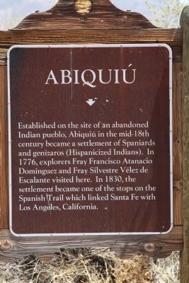
Abiquiú
Topics. This historical marker is listed in these topic lists: Colonial Era • Exploration. A significant historical year for this entry is 1776.
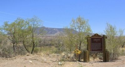
Location. 36° 12.574′ N, 106° 19.146′ W. Marker is in Abiquiu, New Mexico, in Rio Arriba County. Marker is on Highway 84 (U.S. 84 at milepost 211.5) near Local Road 187, on the left when traveling south. It is at Bode’s General Store at the entrance to the town. Touch for map. Marker is at or near this postal address: 21196 Hwy 84, Abiquiu NM 87510, United States of America. Touch for directions.
Other nearby markers. At least 7 other markers are within 12 miles of this marker, measured as the crow flies. Georgia O’Keeffe (approx. 3.7 miles away); Red Rocks (approx. 3.7 miles away); Agueda S. Martinez (1898–2000) (approx. 8 miles away); El Rito (approx. 11.2 miles away); a different marker also named El Rito (approx. 11.3 miles away); Welcome to the Church of San Juan Nepomuceno (approx. 11.8 miles away); Coelophysis Quarry (approx. 12 miles away).
Also see . . .
1. Wikipedia Entry. “In the 1730s, it was the third largest settlement in the Spanish province of Nuevo México. Artist Georgia O'Keeffe lived there from 1949 until shortly before her death in 1986 at 98 years of age.” (Submitted on April 24, 2014.)
2. The Story of Abiquiú. Entry at NewMexicoHistory.org. “The southern boundary of the Abiquiú Genízaro Grant was the subject of a long dispute with the Vallecitos de San Antonio, or Vallecitos Grant to the south between the 1820's and 1831 when the dispute was finally settled. The primary issue was the location of the road to Navajo land. The remaining Genízaros at the pueblo almost rioted when an attempt was made to locate the road 5,000 varas south of the center of the pueblo instead of the 10,000 varas called for in the Vélez Cachupín Grant. Finally a measurement of approximately 10,000 varas was made south of the center of the pueblo where the road (probably the beginning of the Old Spanish Trail ) was found near an old boundary marker.” (Submitted on April 24, 2014.)
Credits. This page was last revised on September 24, 2020. It was originally submitted on April 23, 2014, by J. J. Prats of Powell, Ohio. This page has been viewed 796 times since then and 49 times this year. Photos: 1. submitted on April 23, 2014, by J. J. Prats of Powell, Ohio. 2, 3. submitted on April 24, 2014, by J. J. Prats of Powell, Ohio.
Editor’s want-list for this marker. Photos of the general store, and of the town. • Can you help?


