Waikiki in Honolulu in Honolulu County, Hawaii — Hawaiian Island Archipelago (Pacific Ocean)
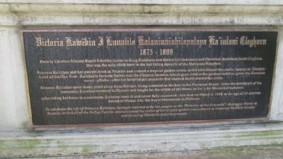
Victoria Kawekiu F Lunalilo Kalaninuiahilapalapu Ka’iulani Cleghorn
1875-1899
Photographed by Denise Boose, April 15, 2014
1. Victoria Kawekiu F Lunalilo Kalaninuiahilapalapu Ka’iulani Cleghorn Marker
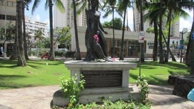
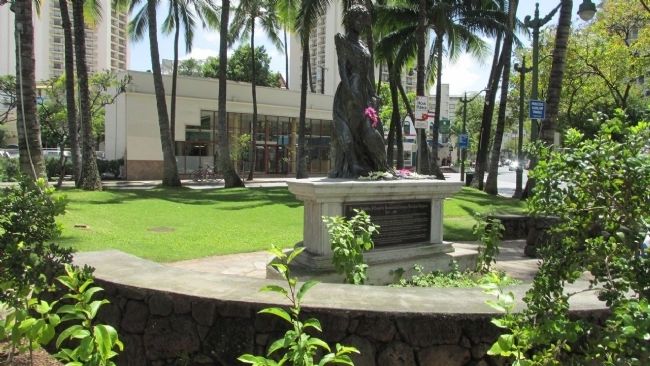
Princess Ka’iulani and her parents lived in Waikīkī and created a tropical garden estate, in the area around this statue, known as ’Āinahau—Land of the Hau Tree. Ka’iulani’s favorite flower was the Chinese Jasmine, which grew wild in the gardens and was given the Hawaiian name—Pīkake—after the beloved pet peacocks that roamed freely around the estate.
Princess Ka’iulani spent many years away from Hawai’i, being schooled as the heir to the Hawaiian throne. After the overthrow of the monarchy, Ka’iulani returned to Hawai’i and fought for the return of the throne to her Aunt Queen Lili’uokalani. After riding her horse in a rainstorm, Ka’iulani took ill and never fully recovered. She died on March 6, 1899, at the age of 23 and was buried at Mauna Ala, the Royal Mausoleum in Nu’uanu.
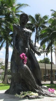
To celebrate the life of Princess Ka’iulani, lovingly referred to by her people as the
this page online
Erected by Outrigger Hotels & Resorts and Kelley Family.
Topics. This historical marker is listed in this topic list: Women. A significant historical month for this entry is March 1874.
Location. 21° 16.656′ N, 157° 49.472′ W. Marker is in Honolulu, Hawaii, in Honolulu County. It is in Waikiki. It is on Kuhio Avenue, on the left when traveling west. This is located in a miniture park surrounded by Kuhio, Ka'lulani and Kanekapolei Street. Touch for map. Marker is in this post office area: Honolulu HI 96815, United States of America. Touch for directions.

Regionally, it is in North America, in Polynesia, in the Pacific Ocean, in North Pacific, on the Pacific Rim, in the Western Hemisphere, in the Western World, and in the Anglosphere.
Other nearby markers. At least 8 other markers are within walking distance of this marker: The Stones Of Life (about 800 feet away, measured in a direct line);
Photographed by Denise Boose, April 15, 2014
2. Victoria Kawekiu F Lunalilo Kalaninuiahilapalapu Ka’iulani Cleghorn Marker
Photographed by Denise Boose, April 15, 2014
3. Victoria Kawekiu F Lunalilo Kalaninuiahilapalapu Ka’iulani Cleghorn Marker
Photographed by Denise Boose, April 15, 2014
4. Victoria Kawekiu F Lunalilo Kalaninuiahilapalapu Ka’iulani Cleghorn Marker
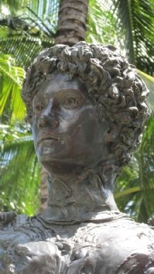
Photographed by Denise Boose, April 15, 2014
5. Victoria Kawekiu F Lunalilo Kalaninuiahilapalapu Ka’iulani Cleghorn Marker
Credits. This page was last revised on February 10, 2023. It was originally submitted on April 25, 2014, by Denise Boose of Tehachapi, California. This page has been viewed 1,010 times since then and 119 times this year. Photos: 1, 2, 3, 4, 5. submitted on April 25, 2014, by Denise Boose of Tehachapi, California. • Bill Pfingsten was the editor who published this page.
