Marker Logo HMdb.org THE HISTORICAL
MARKER DATABASE
“Bite-Size Bits of Local, National, and Global History”
Sharpsburg in Washington County, Maryland — The American Northeast (Mid-Atlantic)
 

Lutheran Cemetery


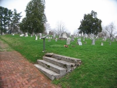
Lutheran Cemetery Marker image. Click for full size.
Photographed By Craig Swain, April 6, 2008
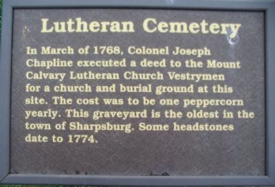
1. Lutheran Cemetery Marker
Inscription. In March of 1768, Colonel Joseph Chapline executed a deed to the Mount Cavalry Lutheran Church Vestrymen for a church and burial ground at this site. The cost was to be one peppercorn yearly. This graveyard is the oldest in the town of Sharpsburg. Some headstones date to 1774.
 
Erected by Washington County Historical Advisory Committee.
 
Topics and series. This historical marker is listed in these topic lists: Cemeteries & Burial SitesChurches & Religion. In addition, it is included in the Maryland, Washington County Historical Advisory Committee series list. A significant historical month for this entry is March 1768.
 
Location. 39° 27.547′ N, 77° 44.707′ W. Marker is in Sharpsburg, Maryland, in Washington County. Marker is on Boonsboro Pike (State Highway 34), on the right when traveling east. Touch for map. Marker is in this post office area: Sharpsburg MD 21782, United States of America. Touch for directions.
 
Other nearby markers. At least 8 other markers are within walking distance of this marker. Collateral Damage (within shouting distance of this marker); Kretzer Homestead (about 600 feet away, measured in a direct line); D.R. Jones' Division, Longstreet's Command (about 700 feet away); a different marker also named D.R. Jones' Division, Longstreet's Command (about 700 feet away); Longstreet's Command
Paid Advertisement
Click on the ad for more information.
Please report objectionable advertising to the Editor.
Click or scan to see
this page online
(about 800 feet away); a different marker also named Longstreet's Command (approx. 0.2 miles away); Hood's Division, Longstreet's Command (approx. 0.2 miles away); Reserve Artillery, Longstreet's Command (approx. 0.2 miles away). Touch for a list and map of all markers in Sharpsburg.
 
Lutheran Cemetery Marker image. Click for full size.
Photographed By Craig Swain, April 6, 2008
2. Lutheran Cemetery Marker
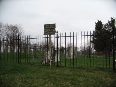
Confederate Signal Station image. Click for full size.
Photographed By Craig Swain, April 6, 2008
3. Confederate Signal Station
A wooden sign in the cemetery points out the 1862 Lutheran Church site. Used as a signal station by Lee. Was also a Union Hospital.
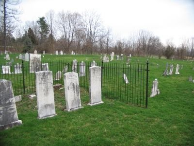
The Lutheran Church Site image. Click for full size.
Photographed By Craig Swain, April 6, 2008
4. The Lutheran Church Site
The Church stood near this iron enclosure. During the Battle of Antietam, the grounds were used by the Confederates both as a staging ground and signal station.
Lutheran Cemetery image. Click for full size.
Photographed By Craig Swain, April 6, 2008
5. Lutheran Cemetery
 
 
Credits. This page was last revised on June 16, 2016. It was originally submitted on April 25, 2008, by Craig Swain of Leesburg, Virginia. This page has been viewed 1,321 times since then and 4 times this year. Photos:   1, 2, 3, 4, 5. submitted on April 25, 2008, by Craig Swain of Leesburg, Virginia.
Share this page.  
Share on Tumblr
m=7339

CeraNet Cloud Computing sponsors the Historical Marker Database.
This website earns income from purchases you make after using our links to Amazon.com. We appreciate your support.
Paid Advertisements
Mar. 19, 2024