Weatherford in Parker County, Texas — The American South (West South Central)
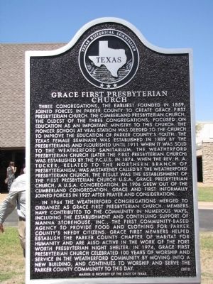
Grace First Presbyterian Church
Photographed by QuesterMark, May 4, 2014
1. Grace First Presbyterian Church Texas Historical Marker
In 1964 the Weatherford congregations merged to organize as Grace First Presbyterian Church. Members have contributed
this page online
Erected 2012 by Texas Historical Commission. (Marker Number 17254.)
Topics. This historical marker is listed in this topic list: Religion & Religious Structures. A significant historical year for this entry is 1859.
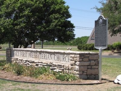
Location. 32° 44.617′ N, 97° 48.833′ W. Marker is in Weatherford, Texas, in Parker County. It is at the intersection of Mockingbird Lane and South Bowie Drive, on the left when traveling east on Mockingbird Lane. The marker is located just to the right of the church sign. Touch for map.
Photographed by QuesterMark, May 4, 2014
2. Grace First Presbyterian Church Sign and Marker

Regionally, this marker is in the Prairies & Lakes Region and in the Dallas-Fort Worth Metropolitan Area. Globally, it is in North America, a Gulf of Mexico state, the Western Hemisphere, the Western World, and the Anglosphere. Historically, it finds itself in what was once New Spain, the Republic of Texas, and one of the Confederate States of America.
Other nearby markers. At least 8 other markers are within 2 miles of this marker, measured as the crow flies: August 17, 1945 B-29 Crash (about 600 feet away, measured in a direct line); Parker County Gold Star Family Memorial Monument (approx. 0.3 miles away); Soldier Spring Park (approx. 0.3 miles away); Chandor Gardens (approx. 0.9 miles away); Mount Pleasant Colored School (approx. 0.9 miles away); Central Christian Church (approx. 0.9 miles away); Governor S.W.T. Lanham (approx. one mile away); Prince Memorial CME Church (approx. 1.1 miles away). Touch for a list and map of all markers in Weatherford.
Credits. This page was last revised on June 16, 2016. It was originally submitted on May 6, 2014, by QuesterMark of Fort Worth, Texas. This page has been viewed 1,033 times since then and 65 times this year. Photos: 1, 2. submitted on May 6, 2014, by QuesterMark of Fort Worth, Texas. • Bernard Fisher was the editor who published this page.
