Brownfield in Terry County, Texas — The American South (West South Central)
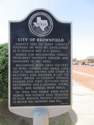
City of Brownfield
Named for Brownfield family, prominent property owners and ranchers in the area.
Measuring with only 100 feet of wire, Hardin and Small laid out a town on this site (then a pasture) and offered a lot to each voter in county. Streets (named for first settlers) were designated and a general store, hotel, and school were built.
In 1904 the town vied with Gomez for county seat, winning by slim margin. Present economy is based on farming and oil.
Erected 1971 by State Historical Survey Committee. (Marker Number 881.)
Topics. This historical marker is listed in this topic list: Settlements & Settlers. A significant historical year for this entry is 1903.
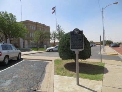
Location. 33° 10.738′ N, 102° 16.866′ W. Marker is in Brownfield, Texas, in Terry County. Marker is at the intersection of West Main Street (U.S. 82/380) and South 6th Street, on the right when traveling east on West Main Street. Marker is on the southeast corner. Touch for map. Marker is in this post office area: Brownfield TX 79316, United States of America. Touch for directions.
Other nearby markers. At least 8 other markers are within 2 miles of this marker, measured as the crow flies. Colonel B. F. Terry / Terry's Texas Rangers (within shouting distance of this marker); Brownfield Municipal Power Plant (about 600 feet away, measured in a direct line); First Baptist Church of Brownfield (approx. ¼ mile away); A.M. Brownfield Home (approx. ¾ mile away); Terry County's First Jail (approx. ¾ mile away); Maids and Matrons Club (approx. ¾ mile away); Brownfield Cemetery (approx. 0.8 miles away); Patriotism (approx. 1.1 miles away). Touch for a list and map of all markers in Brownfield.
Credits. This page was last revised on June 16, 2016. It was originally submitted on May 7, 2014, by Bill Kirchner of Tucson, Arizona. This page has been viewed 503 times since then and 35 times this year. Photos: 1, 2, 3. submitted on May 7, 2014, by Bill Kirchner of Tucson, Arizona. • Bernard Fisher was the editor who published this page.


